
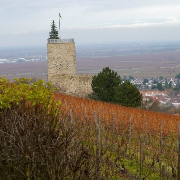

Startpunkt der Tour ist ein Parkplatz in der Nähe der Wachtenburg. Von dort führt die Strecke oberhalb der Weinberge relativ eben in Richtung Deidesheim. Bei schönem Wetter sind herrliche Blicke in die Rheinebene möglich. An einem kleinen Waldparkplatz biegt der Weg in den Pfälzer Wald ein und steigt anschließend auf einem kleinen begrenzten Abschnitt ordentlich an bis hoch zur Michaelskapelle. Auch noch danach führt der Weg ein kleines Stück bergauf bevor es dann wieder kontinuierlich abfallend bis zur Burgruine Wachtenburg und wieder zurück zum Parkplatz geht. Der Turm der Wachtenburg sollte bestiegen werden, da von dort ein herrlicher Ausblick in alle Richtungen gegeben ist.
Galeria trasy


Mapa trasy i profil wysokości
Minimum height 160 m
Maximum height 381 m
More about the tour author

|
isg13 |
Komentarze

GPS tracks
Trackpoints-
GPX / Garmin Map Source (gpx) download
-
TCX / Garmin Training Center® (tcx) download
-
CRS / Garmin Training Center® (crs) download
-
Google Earth (kml) download
-
G7ToWin (g7t) download
-
TTQV (trk) download
-
Overlay (ovl) download
-
Fugawi (txt) download
-
Kompass (DAV) Track (tk) download
-
Karta trasy (pdf) download
-
Original file of the author (gpx) download
More about the tour author
|
|
isg13 |
Add to my favorites
Remove from my favorites
Edit tags
Open track
My score
Rate