Login

Zapomniałeś swój login?

Cookies have to be accepted!
Your browser's cookie functionality is disabled. Please enable this functionality.

Not a member yet?

Register now
Login

Available for registred users only

Log in to use this feature.

Zapomniałeś swój login?

Cookies have to be accepted!
Your browser's cookie functionality is disabled. Please enable this functionality.

Not a member yet?

Register now
Filter
Kategorie
Advanced filters
  • Długość (km)
  • Wysokość
Zapisz filtr Reset filter

TrackRank

QRCode

Technical data

Długość19,6 km Wysokość939 m Way down858 m Czas trwania08:00 h:m Data06.03.2014
Oceny Author Krajobraz Czynnik zadowolenia Kondycja Technika

Statystyka

308 Widoki Oceny 44 Downloads / Pliki do pobrania Przeciętnie
Rate
  • Karta trasy
  • Dojazd
  • Downloads / Pliki do pobrania

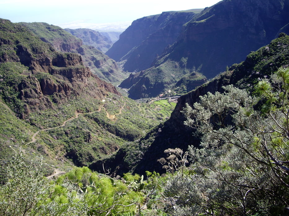
Wanderung zum Höhlenrestaurant Tagoror

Den Steilabstieg zum Restaurant haben wir uns nicht getraut.

Mapa trasy i profil wysokości

  • Open Street Map
  • Google
Minimum height 969 m Maximum height 1731 m Widok szczegółowy

More about the tour author

Kraxel-1
Member since 2013

Send private message

Komentarze

GC-130 Abzw. in der Spitzkehre zw. dem Abzw. zum Nieves und Caldera Marteles

GPS tracks

Trackpoints
  • GPX / Garmin Map Source (gpx) download
  • TCX / Garmin Training Center® (tcx) download
  • CRS / Garmin Training Center® (crs) download
  • Google Earth (kml) download
  • G7ToWin (g7t) download
  • TTQV (trk) download
  • Overlay (ovl) download
  • Fugawi (txt) download
  • Kompass (DAV) Track (tk) download
  • Karta trasy (pdf) download
  • Original file of the author (gpx) download

More about the tour author

Kraxel-1
Member since 2013

Send private message
Share track
Add to my favorites
Remove from my favorites
Edit tags
My score
Rate
Trasa: Barranco de Guayadeque
Rodzaj: Wędrówki
Długość: 19,6 km
Evaluated on:
Czas trwania:
Day(s)
Hour(s)
Minute(s)
Ocena: Krajobraz Czynnik zadowolenia Kondycja Technika