
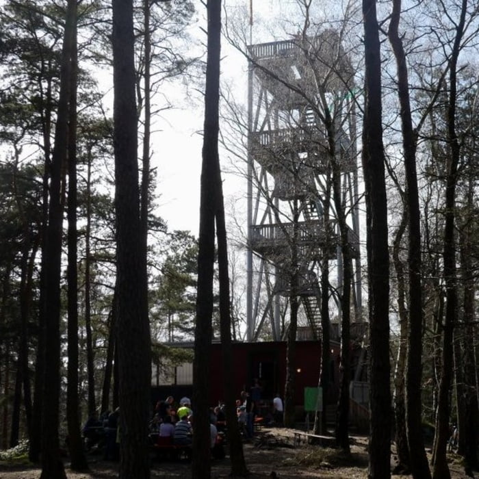

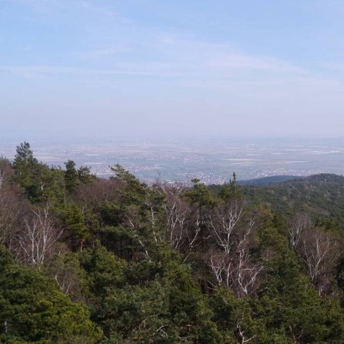
Startpunkt der Tour ist ein kleiner Parkplatz am Fuß des Pfälzerwald. Zunächst führt die Tour durch die Weinberge bis zur Wilhelmshöhle – viele kleine Picknickstellen säumen den Weg, einige davon bieten einen sehr schönen Blick in die Rheinebene. Auf einem gut ausgebauten Forstwirtschaftsweg geht es anschließend hoch zu einem Steinbruch mit schönem See. Von dort geht es weiter bergauf bis zum Eckkopf – die Besteigung des Turms ist zu empfehlen, da von dort ein wunderschöner Ausblick möglich ist. Zurück zum Parkplatz führt ein sehr schöner, kontinuierlich abfallender Wald Pfad.
Galeria trasy


Mapa trasy i profil wysokości
Minimum height 172 m
Maximum height 527 m
More about the tour author

|
isg13 |
Komentarze

GPS tracks
Trackpoints-
GPX / Garmin Map Source (gpx) download
-
TCX / Garmin Training Center® (tcx) download
-
CRS / Garmin Training Center® (crs) download
-
Google Earth (kml) download
-
G7ToWin (g7t) download
-
TTQV (trk) download
-
Overlay (ovl) download
-
Fugawi (txt) download
-
Kompass (DAV) Track (tk) download
-
Karta trasy (pdf) download
-
Original file of the author (gpx) download
More about the tour author
|
|
isg13 |
Add to my favorites
Remove from my favorites
Edit tags
Open track
My score
Rate