
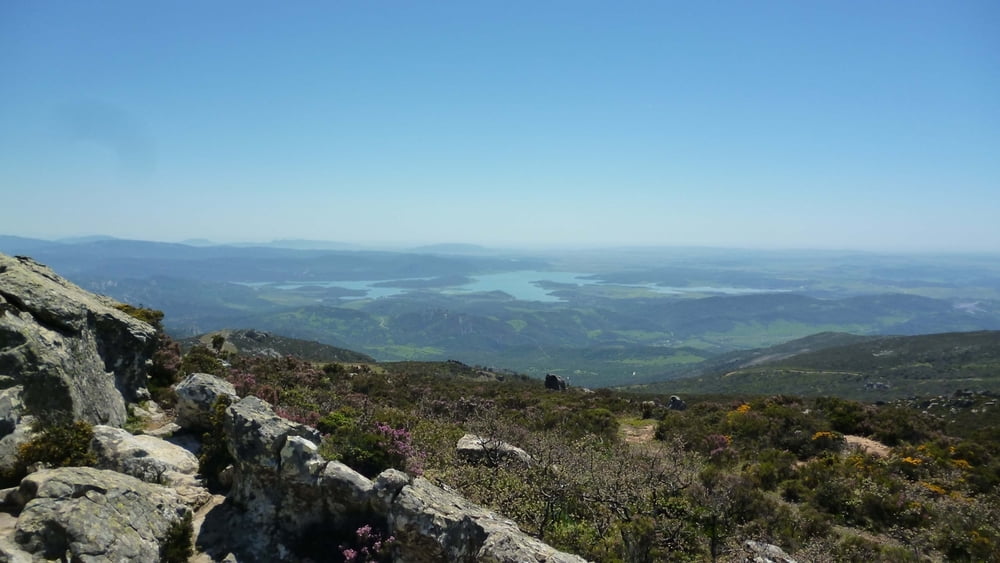

Kurze aber knackige Tour auf den höchsten Berg in der Gegend. Man wird durch einen traumhaften Rundumblick bis zum Felsen von Gibraltar belohnt. Die letzten 220hm bis zum Gipfel haben es in sich. Ein paar kurze Stücke werden auch die Besten schieben müssen - es ist teils felsig und steil. Hinunter macht es dafür aber doppelt so viel Spaß :-)
Mapa trasy i profil wysokości
Minimum height 495 m
Maximum height 1073 m
More about the tour author

|
DonPromillo |
Komentarze

Start- und Zielpunkt: La Sauceda an der C-3331 mitten im Naturpark Los Alcornocales. Am besten über Jimera de la Frontera oder über Alcalá de Los Gazules zu erreichen. Die Autofahrt zum Start der Tour ist schon atemberaubend.
GPS tracks
Trackpoints-
GPX / Garmin Map Source (gpx) download
-
TCX / Garmin Training Center® (tcx) download
-
CRS / Garmin Training Center® (crs) download
-
Google Earth (kml) download
-
G7ToWin (g7t) download
-
TTQV (trk) download
-
Overlay (ovl) download
-
Fugawi (txt) download
-
Kompass (DAV) Track (tk) download
-
Karta trasy (pdf) download
-
Original file of the author (gpx) download
More about the tour author
|
|
DonPromillo |
Add to my favorites
Remove from my favorites
Edit tags
Open track
My score
Rate