


Den Weg nach Kirkel habe nun bald optimiert. Ein paar wenige Varianten sind möglich.
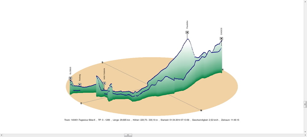
Der Rückweg führte mich an diesem Tag über die Passhöhe in das Taubental. Schön wie einem die Luft um die Nase weht wenn es den Berg runter geht.
An der Fischerhütte vorbei fuhr ich über Schwarzenbach noch zu GLOBUS in Einöd.
Bei den Tennisplätzen in Schwarzenacker gab es als Einlage noch einen netten kleinen Anstieg.
Further information at
https://de.wikipedia.org/wiki/Ein%C3%B6d_(Homburg)Galeria trasy
Mapa trasy i profil wysokości
Minimum height 221 m
Maximum height 330 m
More about the tour author
|
|
Pheinz |
Komentarze

In Schwarzenbach geht es los
GPS tracks
Trackpoints-
GPX / Garmin Map Source (gpx) download
-
TCX / Garmin Training Center® (tcx) download
-
CRS / Garmin Training Center® (crs) download
-
Google Earth (kml) download
-
G7ToWin (g7t) download
-
TTQV (trk) download
-
Overlay (ovl) download
-
Fugawi (txt) download
-
Kompass (DAV) Track (tk) download
-
Karta trasy (pdf) download
-
Original file of the author (gpx) download
More about the tour author
|
|
Pheinz |
Add to my favorites
Remove from my favorites
Edit tags
Open track
My score
Rate