


Wir haben beim Fischerwirt geparkt. Es sind ca.40 km Skating-Loipe verfügbar. Eine relativ neue Web-Site gibt den Zustand an (siehe Link und dann Loipenbericht).
Ortsloipe 10,6km, 50hm einfach zu laufen, häufiger Ski abschnallen um über die Straße zu gelangen; Fuchs-Brand-Loipe 6km, 150hm etwas anspruchsvoller aber sehr schön. Die Loipe Oberautal ist auch ca. 6km lang und hat 70hm.
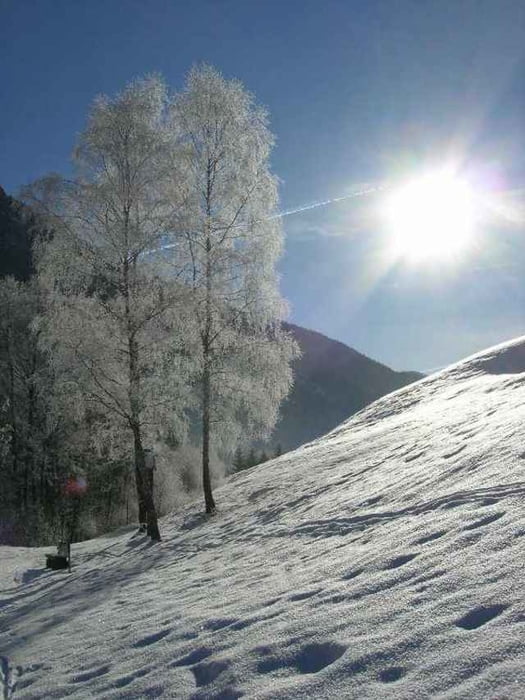
Insgesamt ist es ein schönes Gebiet für einen Tag Langlaufen.
Ortsloipe 10,6km, 50hm einfach zu laufen, häufiger Ski abschnallen um über die Straße zu gelangen; Fuchs-Brand-Loipe 6km, 150hm etwas anspruchsvoller aber sehr schön. Die Loipe Oberautal ist auch ca. 6km lang und hat 70hm.
Insgesamt ist es ein schönes Gebiet für einen Tag Langlaufen.
Further information at
http://www.langlaufen.achensee.infoGaleria trasy
Mapa trasy i profil wysokości
Minimum height 538 m
Maximum height 985 m
More about the tour author

|
smartandem |
Komentarze

Von der A8 in Holzkirchen abfahren und über die B13 über Bad-Tölz und Lenggries zu Sylvenstein-See fahren. Dort links halten Richtung Achensee. Achenkirch ist angeschrieben.
GPS tracks
Trackpoints-
GPX / Garmin Map Source (gpx) download
-
TCX / Garmin Training Center® (tcx) download
-
CRS / Garmin Training Center® (crs) download
-
Google Earth (kml) download
-
G7ToWin (g7t) download
-
TTQV (trk) download
-
Overlay (ovl) download
-
Fugawi (txt) download
-
Kompass (DAV) Track (tk) download
-
Karta trasy (pdf) download
-
Original file of the author (g7t) download
More about the tour author
|
|
smartandem |
Add to my favorites
Remove from my favorites
Edit tags
Open track
My score
Rate