
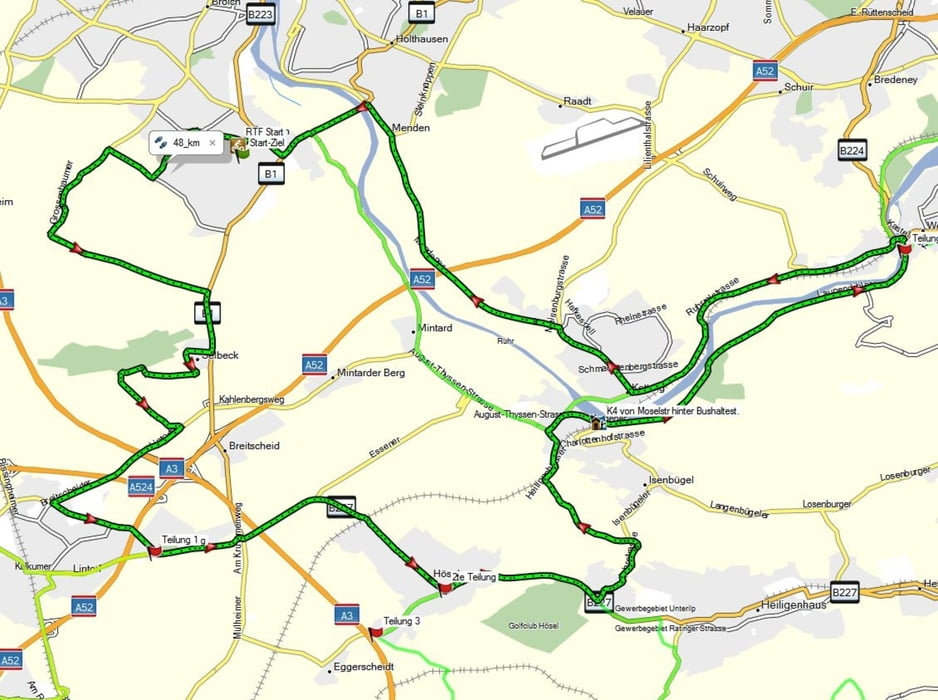

Die 48 km Runde ist unsere Familienrunde. Zwischen Mülheim-Mintard und Essen-Werden lässt es sich flach und flott fahren. Ein paar Körner bvraucht man doch, wenn man in angemessener Zeit wieder zurück sein will, aber ansonsten ist Genuss-Radeln angesagt
Further information at
http://www.ruhrtal-biker.deMapa trasy i profil wysokości
Minimum height 23 m
Maximum height 161 m
More about the tour author
|
|
KMDV00 |
Komentarze

Start und Ziel beim RTC Mülheim e.V.
Mülheim Saarn, Berufskolleg Lehnerstr. 67, 45481 Muelheim an der Ruhr
Mülheim Saarn, Berufskolleg Lehnerstr. 67, 45481 Muelheim an der Ruhr
GPS tracks
Trackpoints-
GPX / Garmin Map Source (gpx) download
-
TCX / Garmin Training Center® (tcx) download
-
CRS / Garmin Training Center® (crs) download
-
Google Earth (kml) download
-
G7ToWin (g7t) download
-
TTQV (trk) download
-
Overlay (ovl) download
-
Fugawi (txt) download
-
Kompass (DAV) Track (tk) download
-
Karta trasy (pdf) download
-
Original file of the author (gpx) download
More about the tour author
|
|
KMDV00 |
Add to my favorites
Remove from my favorites
Edit tags
Open track
My score
Rate