Login

Zapomniałeś swój login?

Cookies have to be accepted!
Your browser's cookie functionality is disabled. Please enable this functionality.

Not a member yet?

Register now
Login

Available for registred users only

Log in to use this feature.

Zapomniałeś swój login?

Cookies have to be accepted!
Your browser's cookie functionality is disabled. Please enable this functionality.

Not a member yet?

Register now
Filter
Kategorie
Advanced filters
  • Długość (km)
  • Wysokość
Zapisz filtr Reset filter

TrackRank

QRCode

Technical data

Długość30,3 km Wysokość881 m Way down861 m Czas trwania02:48 h:m Data21.07.2014
Oceny Author Krajobraz Czynnik zadowolenia Kondycja Technika

Statystyka

108 Widoki Oceny 10 Downloads / Pliki do pobrania Przeciętnie
Rate
  • Karta trasy
  • Dojazd
  • Downloads / Pliki do pobrania

Gute Unterhaltung

Wege: Alles Asfalt

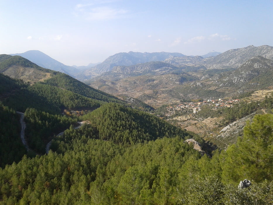
Aussicht: 50% waldig, Rest freie Sicht


Galeria trasy

Mapa trasy i profil wysokości

  • Open Street Map
  • Google
Minimum height 493 m Maximum height 1189 m Widok szczegółowy

More about the tour author

jue52
Member since 2011

Send private message

Komentarze

Auto auf D695


GPS tracks

Trackpoints
  • GPX / Garmin Map Source (gpx) download
  • TCX / Garmin Training Center® (tcx) download
  • CRS / Garmin Training Center® (crs) download
  • Google Earth (kml) download
  • G7ToWin (g7t) download
  • TTQV (trk) download
  • Overlay (ovl) download
  • Fugawi (txt) download
  • Kompass (DAV) Track (tk) download
  • Karta trasy (pdf) download
  • Original file of the author (gpx) download

More about the tour author

jue52
Member since 2011

Send private message
Share track
Add to my favorites
Remove from my favorites
Edit tags
My score
Rate
Trasa: Murtici-Cukurköy-Güzelsu 23.11.13
Rodzaj: Rower górski (MTB)
Długość: 30,3 km
Evaluated on:
Czas trwania:
Day(s)
Hour(s)
Minute(s)
Ocena: Krajobraz Czynnik zadowolenia Kondycja Technika