Login

Zapomniałeś swój login?

Cookies have to be accepted!
Your browser's cookie functionality is disabled. Please enable this functionality.

Not a member yet?

Register now
Login

Available for registred users only

Log in to use this feature.

Zapomniałeś swój login?

Cookies have to be accepted!
Your browser's cookie functionality is disabled. Please enable this functionality.

Not a member yet?

Register now
Filter
Kategorie
Advanced filters
  • Długość (km)
  • Wysokość
Zapisz filtr Reset filter

TrackRank

QRCode

Technical data

Długość15,4 km Wysokość573 m Way down563 m Czas trwania00:00 h:m Data29.07.2014
Oceny Author Krajobraz Czynnik zadowolenia Kondycja Technika

Statystyka

201 Widoki Oceny 26 Downloads / Pliki do pobrania Przeciętnie
Rate
  • Karta trasy
  • Dojazd
  • Downloads / Pliki do pobrania

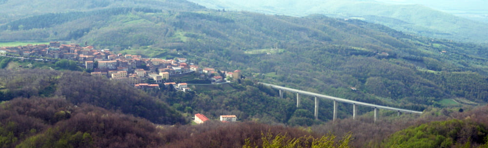
Wanderung durch kühlen Wald - vom tollen Aussichtspunkt "Croce die Prata" auf guten Wegen nach Niccioleta.

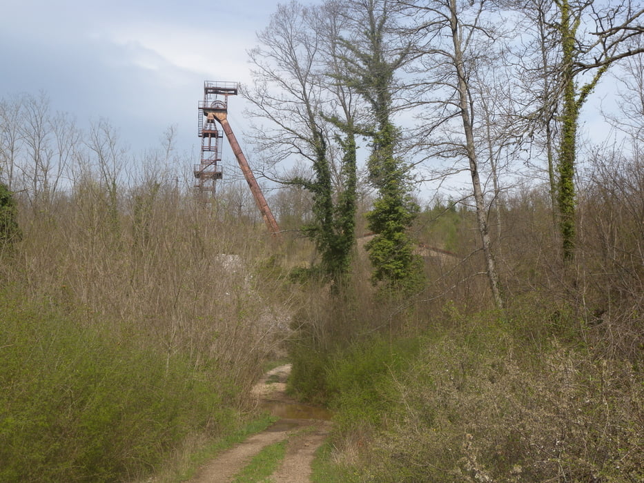
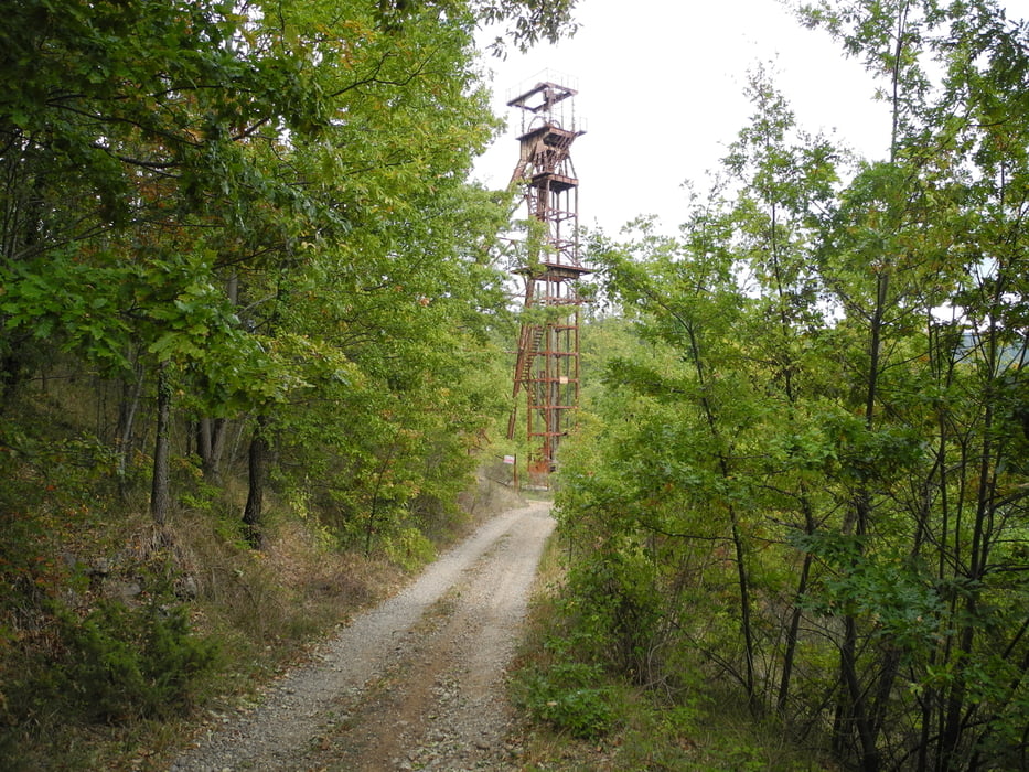
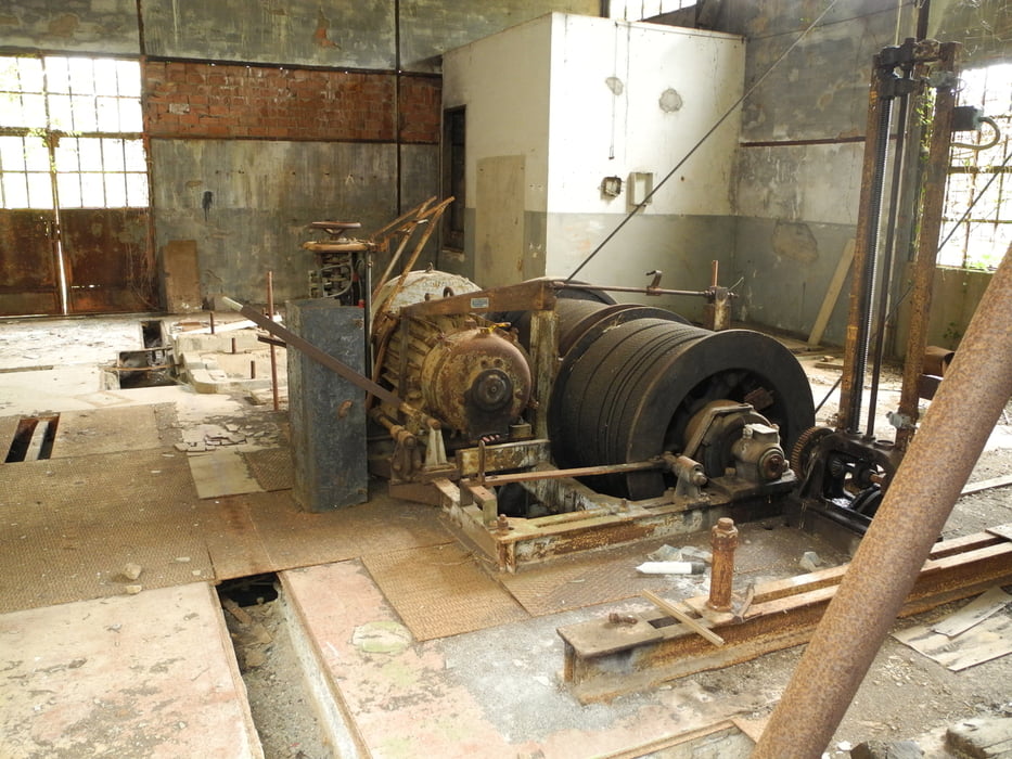
Man trifft unterwegs die Ruinen der ehemaligen Anlagen der Minen in denen bis in die 80-Jahre verschiedene Metalle (z.B. Pyrit) abgebaut wurden.


Galeria trasy

Mapa trasy i profil wysokości

  • Open Street Map
  • Google
Minimum height 379 m Maximum height 855 m Widok szczegółowy

More about the tour author

gerosa
Member since 2009

Send private message

Komentarze

Nach Prata fährt ein Bus ab Massa Marittima und ebenso einer ab Nicciolet zurück nach Massa Marittima.


GPS tracks

Trackpoints
  • GPX / Garmin Map Source (gpx) download
  • TCX / Garmin Training Center® (tcx) download
  • CRS / Garmin Training Center® (crs) download
  • Google Earth (kml) download
  • G7ToWin (g7t) download
  • TTQV (trk) download
  • Overlay (ovl) download
  • Fugawi (txt) download
  • Kompass (DAV) Track (tk) download
  • Karta trasy (pdf) download
  • Original file of the author (gpx) download

More about the tour author

gerosa
Member since 2009

Send private message
Share track
Add to my favorites
Remove from my favorites
Edit tags
My score
Rate
Trasa: 05_Ein Kreuz mit Aussicht
Rodzaj: Wędrówki
Długość: 15,4 km
Evaluated on:
Czas trwania:
Day(s)
Hour(s)
Minute(s)
Ocena: Krajobraz Czynnik zadowolenia Kondycja Technika