


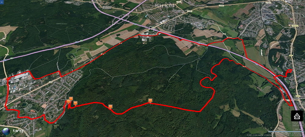
Nette Tagesrunde von Schwarzenbach nach Kirkel auf wohlbekanntem Weg.
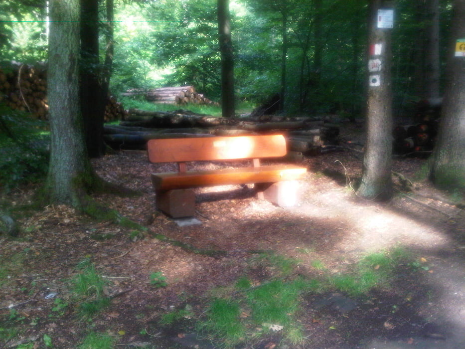
Nach getanem Tagewerk durch Neuhäusel hindurch und bei der Kirkeler Burg auf einem knackigen Pfad ein paar Meter bergauf um dann auf einem schmalen Pfad an den Felsen vorbei bis zum Forstweg und auf diesem dann durch den östlichen Kirkeler Wald über die 7 Fichten in Richtung Kloster Wörschweiler.
Allerdings nicht zum Kloster hinunter sondern vorher links einen Forstweg runter und dann immer am Berghang entlang bis nach schönen Abfahrten die Straße erreicht wird.
Der weitere Rückweg ist dann nur noch flach und eine schöne Entspannung nach so mancher Pfütze.
Macht Spass.
Further information at
https://de.wikipedia.org/wiki/Sankt_Ingbert-Kirkeler_WaldgebietGaleria trasy
Mapa trasy i profil wysokości
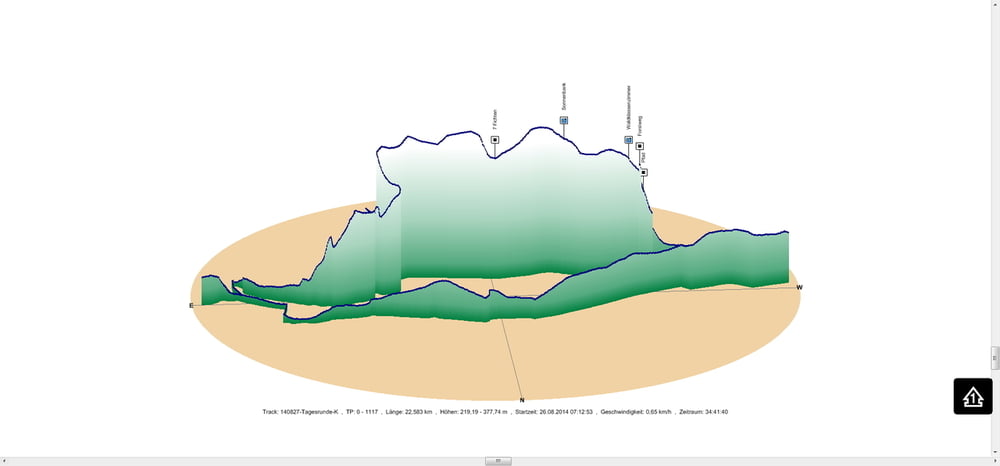
Minimum height 219 m
Maximum height 378 m
More about the tour author
|
|
Pheinz |
Komentarze

Los geht es in Schwarzenbach.
GPS tracks
Trackpoints-
GPX / Garmin Map Source (gpx) download
-
TCX / Garmin Training Center® (tcx) download
-
CRS / Garmin Training Center® (crs) download
-
Google Earth (kml) download
-
G7ToWin (g7t) download
-
TTQV (trk) download
-
Overlay (ovl) download
-
Fugawi (txt) download
-
Kompass (DAV) Track (tk) download
-
Karta trasy (pdf) download
-
Original file of the author (gpx) download
More about the tour author
|
|
Pheinz |
Add to my favorites
Remove from my favorites
Edit tags
Open track
My score
Rate