Login

Zapomniałeś swój login?

Cookies have to be accepted!
Your browser's cookie functionality is disabled. Please enable this functionality.

Not a member yet?

Register now
Login

Available for registred users only

Log in to use this feature.

Zapomniałeś swój login?

Cookies have to be accepted!
Your browser's cookie functionality is disabled. Please enable this functionality.

Not a member yet?

Register now
Filter
Kategorie
Advanced filters
  • Długość (km)
  • Wysokość
Zapisz filtr Reset filter

TrackRank

QRCode

Technical data

Długość9,4 km Wysokość632 m Way down625 m Czas trwania00:00 h:m Data31.08.2014
Oceny Author Krajobraz Czynnik zadowolenia Kondycja Technika

Statystyka

220 Widoki Oceny 38 Downloads / Pliki do pobrania Przeciętnie
Rate
  • Karta trasy
  • Dojazd
  • Downloads / Pliki do pobrania

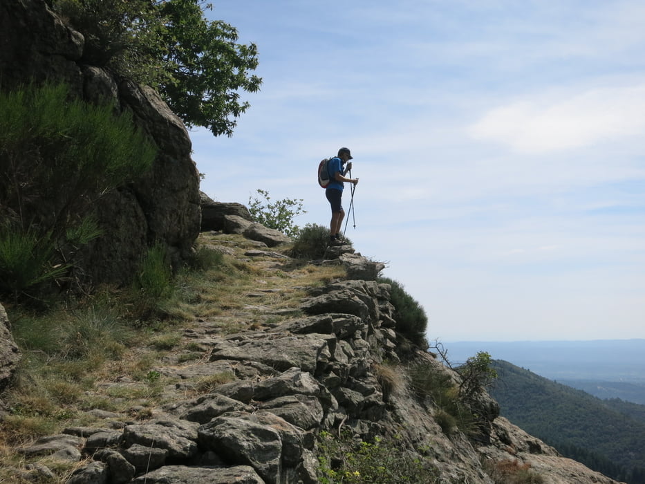
Steile anspruchsvolle Wanderung in den Cevennen bei Rocles.

Der Pfad führt über alte Pfade, welche für die Ernte der Kastanien angelegt worden sind, steil durch wunderschöne Kastanienwälder bergauf.

Oben auf der Krete hat meinen wunderbaren Rundblick über die Cevennen.

Der Abstieg ist sehr steil und zum Teil ein wenig ausgesetzt


Galeria trasy

Mapa trasy i profil wysokości

  • Open Street Map
  • Google
Minimum height 470 m Maximum height 1085 m Widok szczegółowy

More about the tour author

Dietsch1
Member since 2010

Send private message

Komentarze

Anfahrt via Largentierès auf den Col de la Croix de Rocles, wo man ein paar Parkplätze vorfindet.

GPS tracks

Trackpoints
  • GPX / Garmin Map Source (gpx) download
  • TCX / Garmin Training Center® (tcx) download
  • CRS / Garmin Training Center® (crs) download
  • Google Earth (kml) download
  • G7ToWin (g7t) download
  • TTQV (trk) download
  • Overlay (ovl) download
  • Fugawi (txt) download
  • Kompass (DAV) Track (tk) download
  • Karta trasy (pdf) download
  • Original file of the author (gpx) download

More about the tour author

Dietsch1
Member since 2010

Send private message
Share track
Add to my favorites
Remove from my favorites
Edit tags
My score
Rate
Trasa: In den Bergen von Rocles
Rodzaj: Wędrówki
Długość: 9,4 km
Evaluated on:
Czas trwania:
Day(s)
Hour(s)
Minute(s)
Ocena: Krajobraz Czynnik zadowolenia Kondycja Technika