
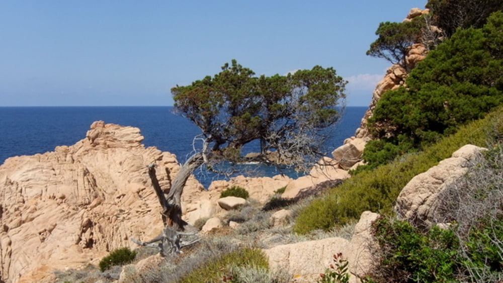

Wir parken kurz vor der Schranke zum Ressort CalaRossa. Unser Ziel ist aber nicht der Strand vom Ferienresort, sondern die Küstenwanderung hin zum Spaggia Tinnari. Der Weg an sich ist nicht lang, aber es geht über Stock & Stein, Hoch & Runter, Mal links - mal rechts herum. Der Weg ist auch recht gut präpariert, die Macchia ist behauen und an den Schlüsselstellen stehen Steinberge als Markierung. Dazu kommt heute aber intensiver Sonnenschein (26°C) und ab und zu ein laues Lüftchen. Da wir nur in leichten Wandersandalen unterwegs sind stoppen wir unsere Tour an einer schönen Bucht und erfrischen uns dort. Später, mit festen Schuhen, werden wir den Weg noch einmal bis zum Strand weiterlaufen...
Mapa trasy i profil wysokości
Minimum height 3 m
Maximum height 55 m
More about the tour author

|
Huegelfred |
Komentarze

von der SP90 - Abzweig Cala Rossa / Monte Tinnari
GPS tracks
Trackpoints-
GPX / Garmin Map Source (gpx) download
-
TCX / Garmin Training Center® (tcx) download
-
CRS / Garmin Training Center® (crs) download
-
Google Earth (kml) download
-
G7ToWin (g7t) download
-
TTQV (trk) download
-
Overlay (ovl) download
-
Fugawi (txt) download
-
Kompass (DAV) Track (tk) download
-
Karta trasy (pdf) download
-
Original file of the author (gpx) download
More about the tour author
|
|
Huegelfred |
Add to my favorites
Remove from my favorites
Edit tags
Open track
My score
Rate