
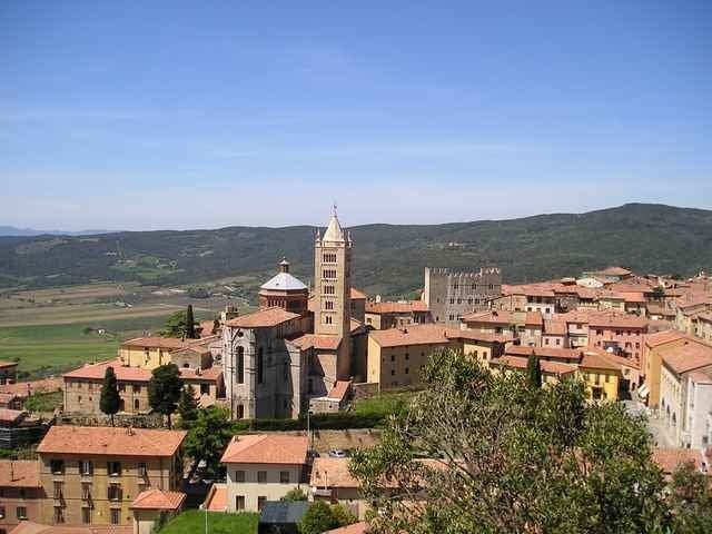

Halbtagestour "Massa Marittima" mit Besichtigung der Etruskerstadt Massa Marittima.
Die Tour startet mit einem technisch schönen, aber anspruchsvollen Aufstieg von ungefähr einer Stunde.
Als Lohn für den Aufstieg winkt eine traumhaft schöne Singletrailabfahrt, in Richtung Perolla.
Anschließend erfolgt, auf Feldwegen und einem schönen Singeltrail, der Aufstieg nach Massa Marittima, mit abschließender Besichtigung des Ortes.
Further information at
http://www.alpstours.de/Mapa trasy i profil wysokości
Minimum height 196 m
Maximum height 488 m
More about the tour author

|
Komentarze

Wie komme ich nach Massa Vecchia
Milano – Richtung Bologna – vor Parma Nord Richtung La Spezia (Cisapass) –vor La Spezia Richtung Livorno - vor Livorno Richtung Rosignano / Roma (SS1). Ausfahrt Follonica Est, folgen Sie dann der Strasse Richtung Massa Marittima. Am Fuss von Massa Marittima finden Sie rechts eine ESSO-Tankstelle. Bleiben Sie auf der Hauptstrasse Richtung Siena (nicht nach Massa Marittima abbiegen). Nach ca. 1.6 km beachten Sie bitte rechts das kleine Schild von Massa Vecchia und biegen Sie rechts in die Schotterstrasse ein.
Brenner – Bologna – Firenze – Superstrada Richtung Siena, Ausfahrt Colle Val d’Elsa, folgen Sie dann der Strasse Richtung Follonica/Massa Marittima. Erste Abbiegung nach Massa Marittima/Ghirlanda nicht benuetzen sondern folgen Sie weiterhin der Hauptstrasse Richtung Follonica. Nach ca. 3 km beachten Sie bitte links das kleine Schild von Massa Vecchia und biegen Sie links in die Schotterstrasse ein.
GPS tracks
Trackpoints-
GPX / Garmin Map Source (gpx) download
-
TCX / Garmin Training Center® (tcx) download
-
CRS / Garmin Training Center® (crs) download
-
Google Earth (kml) download
-
G7ToWin (g7t) download
-
TTQV (trk) download
-
Overlay (ovl) download
-
Fugawi (txt) download
-
Kompass (DAV) Track (tk) download
-
Karta trasy (pdf) download
More about the tour author
|
|
Add to my favorites
Remove from my favorites
Edit tags
Open track
My score
Rate