


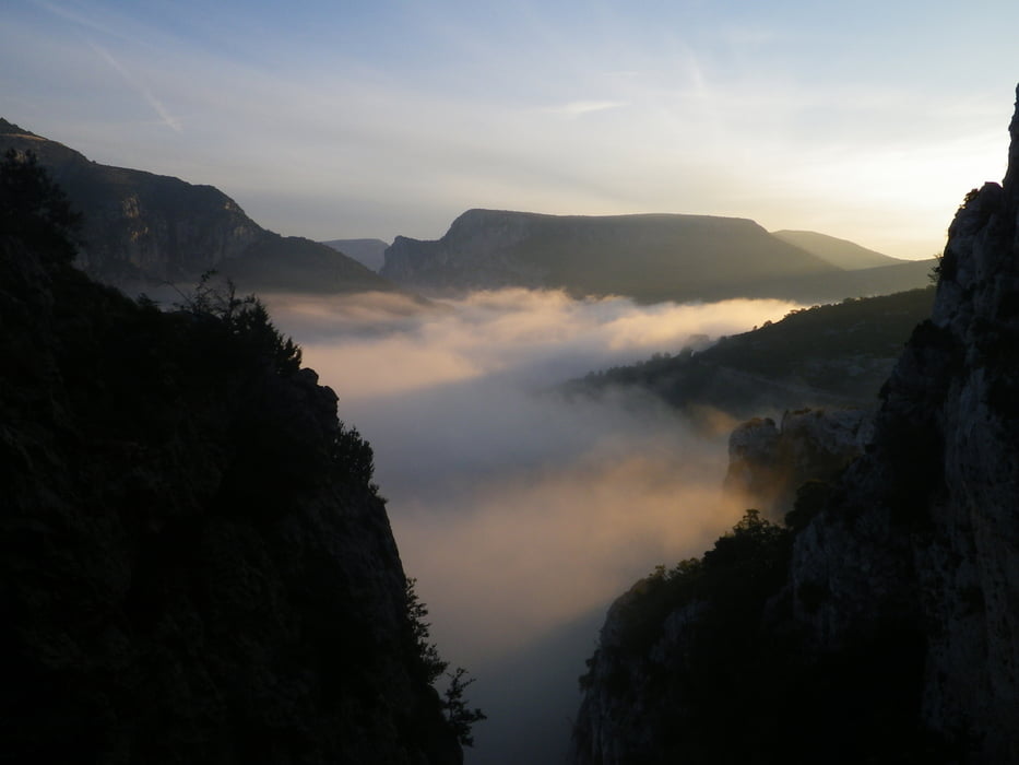
Schöne Aussichtstour zum Nordrand der Verdonschlucht. Gesamte Strecke auf Asphalt.
Es ist zu empfehlen, die Runde morgens oder abends zu fahren, da es auch eine beliebte Aussichtsrunde mit dem Auto ist.
Man sollte sich für die Tour Zeit nehmen, um an den View Points anzuhalten und den Blick in die Schlucht zu genießen.
Galeria trasy

Mapa trasy i profil wysokości
Minimum height 798 m
Maximum height 1322 m
More about the tour author

|
BretzkeR |
Komentarze

Start in La Palud-sur-Verdon
GPS tracks
Trackpoints-
GPX / Garmin Map Source (gpx) download
-
TCX / Garmin Training Center® (tcx) download
-
CRS / Garmin Training Center® (crs) download
-
Google Earth (kml) download
-
G7ToWin (g7t) download
-
TTQV (trk) download
-
Overlay (ovl) download
-
Fugawi (txt) download
-
Kompass (DAV) Track (tk) download
-
Karta trasy (pdf) download
-
Original file of the author (gpx) download
More about the tour author
|
|
BretzkeR |
Add to my favorites
Remove from my favorites
Edit tags
Open track
My score
Rate