
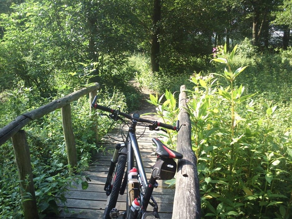

Startlocatie is de Wite Stein in Reuver. De route bestaat uit twee lussen waarvan de bovenste lus het zwaarste is. Hier kom je enorm veel technische singletracks tegen in combinatie met de nodige hoogteverschillen. Bij sommige klimmetjes zal je nog flink moeten aanpoten wil je ze fietsend boven komen. De zuidelijke lus kan je wat beter de snelheid erin houden, hier zitten voornamelijk snelle stukken in. Vlakbij het zwembad in Swalmen kom je op een gedeelte uit met leuke bruggetjes, dit gedeelte is extreem modderig met regenachtig weer. Op het meest zuidelijke punt van de route kom je op het vijf guldenpad uit. Dit is een erg mooie singletrack met ongeveer vijf tot zes korte beklimmingen. Als je dit pad eenmaal gehad hebt gaat de route redelijk eenvoudig terug naar het begin.
Galeria trasy

Mapa trasy i profil wysokości
Minimum height 6 m
Maximum height 70 m
More about the tour author

|
ATBRides |
Komentarze

Startlocatie: De Witte Stein in Reuver.
GPS tracks
Trackpoints-
GPX / Garmin Map Source (gpx) download
-
TCX / Garmin Training Center® (tcx) download
-
CRS / Garmin Training Center® (crs) download
-
Google Earth (kml) download
-
G7ToWin (g7t) download
-
TTQV (trk) download
-
Overlay (ovl) download
-
Fugawi (txt) download
-
Kompass (DAV) Track (tk) download
-
Karta trasy (pdf) download
-
Original file of the author (gpx) download
More about the tour author
|
|
ATBRides |
Add to my favorites
Remove from my favorites
Edit tags
Open track
My score
Rate