


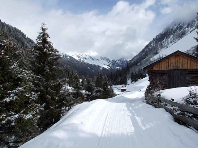
Die Tour startet auf den letzten kostenlosen Parkplätzen des Tales in Richtung Franz Senn Hütte. Es werden zwei Futterstellen passiert, die aber im Winter geschlossen haben. Im Tal selbst ist der Weg einfach und ohne besondere Ausrüstung begehbar. Die Landschaft ist schön und abwechslungsreich. Ab Oberrisshütte wird die Strecke deutlich schwieriger (und es gibt dann auch keine Mobilfunkanbindung mehr). Schneeschuhe und Stöcke sind im Winter unbedingt ratsam!!! Im Sommer sollten es mindestens halbhohe Wanderschuhe sein.
Im Winter gibt es auf der Tour keine offene Futterstelle.
Die Tour ist mit Tourenski befahrbar, aber nichts für Anfänger.
Die Tour endet an der Alpeiner Alm und führt auf gleicher Strecke zurück.
Im Sommer dürfte die Tour in ca. 3,5 h zu schaffen sein.
Im Winter gibt es auf der Tour keine offene Futterstelle.
Die Tour ist mit Tourenski befahrbar, aber nichts für Anfänger.
Die Tour endet an der Alpeiner Alm und führt auf gleicher Strecke zurück.
Im Sommer dürfte die Tour in ca. 3,5 h zu schaffen sein.
Further information at
http://www.franzsennhuette.at/Galeria trasy
Mapa trasy i profil wysokości
Minimum height 1409 m
Maximum height 2004 m
More about the tour author

|
Komentarze

Anfahrt über Insbruck, Stubaital und Milders
GPS tracks
Trackpoints-
GPX / Garmin Map Source (gpx) download
-
TCX / Garmin Training Center® (tcx) download
-
CRS / Garmin Training Center® (crs) download
-
Google Earth (kml) download
-
G7ToWin (g7t) download
-
TTQV (trk) download
-
Overlay (ovl) download
-
Fugawi (txt) download
-
Kompass (DAV) Track (tk) download
-
Karta trasy (pdf) download
-
Original file of the author (gpx) download
More about the tour author
|
|
Add to my favorites
Remove from my favorites
Edit tags
Open track
My score
Rate