


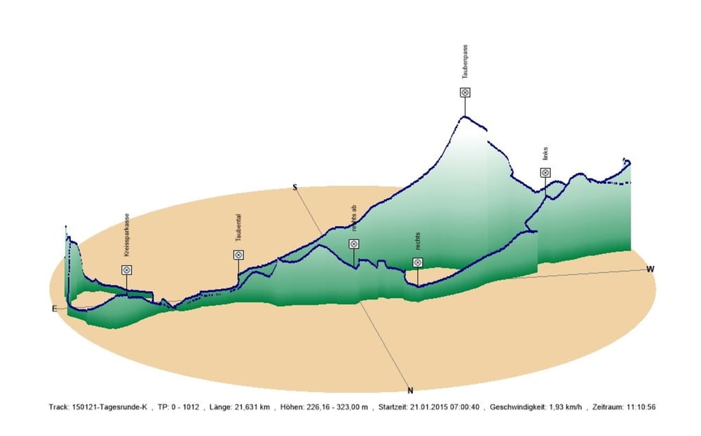
Die Strecke durch das Taubental über den Pass von Schwarzenbach über den Pass fahre ich so oft ich Lust habe. Und die habe ich jetzt im Winter anscheinen öfter als im letzten Sommer.
Den Rückweg nahm ich dann über den Radweg durch die Felder zum Gewerbegebiet "An der Autobahn". Danach fuhr ich östlich zur A8 auf dem Feldweg um währenddessen festzustellen dass ich meine Barschaft auffrischen sollte. Aus diesem Grund fuhr ich an der Kreissparkasse in Beeden vorbei und danach erst zum Ausgangspunkt zurück.
Den Rückweg nahm ich dann über den Radweg durch die Felder zum Gewerbegebiet "An der Autobahn". Danach fuhr ich östlich zur A8 auf dem Feldweg um währenddessen festzustellen dass ich meine Barschaft auffrischen sollte. Aus diesem Grund fuhr ich an der Kreissparkasse in Beeden vorbei und danach erst zum Ausgangspunkt zurück.
Further information at
https://de.wikipedia.org/wiki/HomburgGaleria trasy
Mapa trasy i profil wysokości
Minimum height 226 m
Maximum height 323 m
More about the tour author
|
|
Pheinz |
Komentarze

In Schwarzenbach geht es los.
GPS tracks
Trackpoints-
GPX / Garmin Map Source (gpx) download
-
TCX / Garmin Training Center® (tcx) download
-
CRS / Garmin Training Center® (crs) download
-
Google Earth (kml) download
-
G7ToWin (g7t) download
-
TTQV (trk) download
-
Overlay (ovl) download
-
Fugawi (txt) download
-
Kompass (DAV) Track (tk) download
-
Karta trasy (pdf) download
-
Original file of the author (gpx) download
More about the tour author
|
|
Pheinz |
Add to my favorites
Remove from my favorites
Edit tags
Open track
My score
Rate