


Diesmal führte mich mein Fußweg zuerst zum Bahnhof in
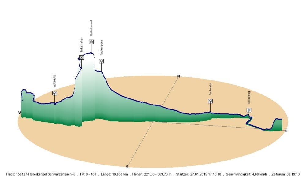
Kirkel-Neuhäuselund von dort durch den Ort zum WASGAU mit seiner guten Metzgertheke.
Danach wanderte ich hinter der Burg den steilen und bei Dunkelheit etwas diffizilen Weg hoch auf die Wegkreuzung beim
. Hier bog ich nicht auf den guten Forstweg ab, sondern wanderte leicht ansteigend über die Hollerkanzel.
Von nun an giengs bergab. Zuerst fiel der Weg recht steil bis zum Taubenpass ab. Gerade m Winter bei Dunkelheit kann hier eine Lampe von Vorteil sein.
Danach wanderte ich das Taubental hinaus und erreichte durch das Bliestal mein Ziel in
.
Further information at
http://www.saarpfalz-touristik.de/Galeria trasy
Mapa trasy i profil wysokości
Minimum height 222 m
Maximum height 370 m
More about the tour author
|
|
Pheinz |
Komentarze

Im Gewerbegebiet in Kirkel-Neuhäusel geht es los.
GPS tracks
Trackpoints-
GPX / Garmin Map Source (gpx) download
-
TCX / Garmin Training Center® (tcx) download
-
CRS / Garmin Training Center® (crs) download
-
Google Earth (kml) download
-
G7ToWin (g7t) download
-
TTQV (trk) download
-
Overlay (ovl) download
-
Fugawi (txt) download
-
Kompass (DAV) Track (tk) download
-
Karta trasy (pdf) download
-
Original file of the author (gpx) download
More about the tour author
|
|
Pheinz |
Add to my favorites
Remove from my favorites
Edit tags
Open track
My score
Rate