
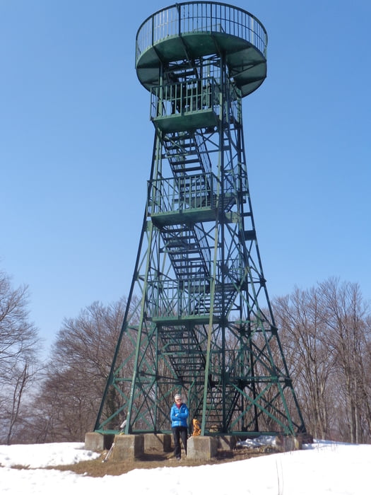

Wir starten an der Soiceva kuca, einem kleinen Gasthaus mit Garten und gehen bis zur Gabelung. Dort rechts vorbei an der Kapelle und den Häusern den Berg hoch zum Waldrand. Links den Hauptweg weiter bis zu einer Gabelung. Hier mittig weiter durch den Buchen- und Tannenwald bis man auf eine breite Forststraße stößt. Diese links folgen und bei Punkt 67 zweigt ein schmaler Pfad nach links Richtung Gipfel ab. Kurz darauf steht man auf der Hochfläche mit dem Aussichtsturm (Pun kt 68)
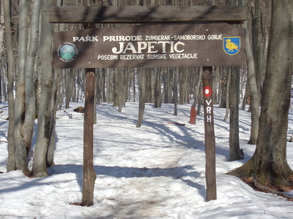
Zurück zur Forststraße mit einem Abstecher zur Bergühtte Japetic (Punkt 69). Wieder zurück zur Gabelung, hier rechts und danach wieder rechts in den kleinen markierten Waldpfad abzweigen. Etwas steiler bergab zu einer Asphaltstraße. Dieser folgen wir zum lang gezogenen Ort Mali Lipovec. Nach dem Ort noch ca. 1 km auf der Asphaltstraße bergab zum Ausganspunkt.
Galeria trasy

Mapa trasy i profil wysokości
Minimum height 370 m
Maximum height 888 m
More about the tour author

|
JoHangler |
Komentarze

Von Zagreb nach Samobor. Durch den Ort Richtung Smerovisce zum Gasthaus.
GPS tracks
Trackpoints-
GPX / Garmin Map Source (gpx) download
-
TCX / Garmin Training Center® (tcx) download
-
CRS / Garmin Training Center® (crs) download
-
Google Earth (kml) download
-
G7ToWin (g7t) download
-
TTQV (trk) download
-
Overlay (ovl) download
-
Fugawi (txt) download
-
Kompass (DAV) Track (tk) download
-
Karta trasy (pdf) download
-
Original file of the author (gpx) download
More about the tour author
|
|
JoHangler |
Add to my favorites
Remove from my favorites
Edit tags
Open track
My score
Rate