


Kleine Runde bei Böbingen um den Kopf zu lüften.
Start bei der evangelischen Michaelskirche und dann den Christenberg runter und den Trieb hoch auf die Ungerhalde. Immer auf dem schmalen Asphaltsträßchen bleiben bis an der Rechtskurve ein neu gebauter und jetzt auch asphaltierter Feldweg nach links zum Bruckholz abbiegt.
Am nordwestlichen Waldeck nach links abbiegen und am Waldrand entlanggehen.
Bald darauf den nun gut gehbaren Forstweg in den Wald und die erste Abzweigung nach links auf einen älteren Waldweg wechseln.
Nachdem der Wald verlassen wurde am Bubenrain bei der Grillhüttee vorbei und auf dem Feldweg zurück zum Ausgangspunkt.
Further information at
http://www.boebingen.de/index.php?id=110Galeria trasy


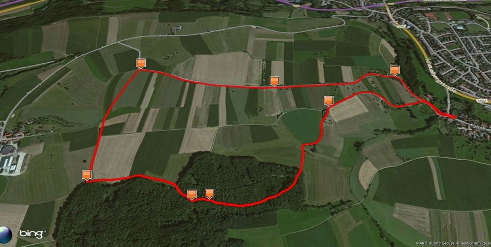
Mapa trasy i profil wysokości
Minimum height 407 m
Maximum height 460 m
More about the tour author
|
|
Pheinz |
Komentarze

Start an der Michaelskirche in Oberböbingen.
GPS tracks
Trackpoints-
GPX / Garmin Map Source (gpx) download
-
TCX / Garmin Training Center® (tcx) download
-
CRS / Garmin Training Center® (crs) download
-
Google Earth (kml) download
-
G7ToWin (g7t) download
-
TTQV (trk) download
-
Overlay (ovl) download
-
Fugawi (txt) download
-
Kompass (DAV) Track (tk) download
-
Karta trasy (pdf) download
-
Original file of the author (gpx) download
More about the tour author
|
|
Pheinz |
Add to my favorites
Remove from my favorites
Edit tags
Open track
My score
Rate