

Auf den Spuren der Steillagen-Winzer.
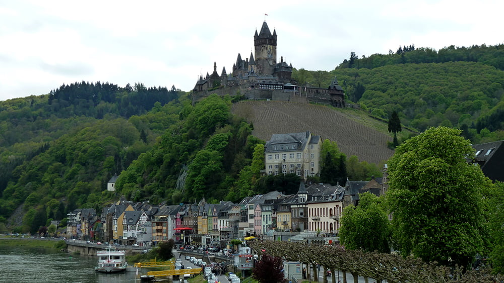
Wer diese Etappe und ihre zahlreichen Steillagen bewältigt hat, kann nachvollziehen, welche Mühen der Weinbau an der Mosel mit sich bringt. Die felsigen Pfade entlang der Hangkante erfordern einige Trittsicherheit, bieten jedoch auf weiten Strecken unvergessliche Ausblicke über die Mosel. Schließlich führt der Weg unterhalb der senkrechten Felswand der Brauselay, von wo schon das Etappenziel Cochem im Blick liegt, überragt von seiner märchenhaft schönen Reichsburg. Mit diesem schönen Ziel vor Augen führt der Moselsteig hinab in die gastfreundliche Stadt. Dann geht es nochmal steil Bergan zum Wild und Freizeitpark Klotten. Das letzte Stück des Moselsteigs geht bis zum Ziel Klotten fast immer abwärts.
Galeria trasy


Mapa trasy i profil wysokości
Minimum height 80 m
Maximum height 318 m
More about the tour author
|
|
schleidy |
Komentarze

GPS tracks
Trackpoints-
GPX / Garmin Map Source (gpx) download
-
TCX / Garmin Training Center® (tcx) download
-
CRS / Garmin Training Center® (crs) download
-
Google Earth (kml) download
-
G7ToWin (g7t) download
-
TTQV (trk) download
-
Overlay (ovl) download
-
Fugawi (txt) download
-
Kompass (DAV) Track (tk) download
-
Karta trasy (pdf) download
-
Original file of the author (gpx) download
More about the tour author
|
|
schleidy |
Add to my favorites
Remove from my favorites
Edit tags
Open track
My score
Rate