Login

Zapomniałeś swój login?

Cookies have to be accepted!
Your browser's cookie functionality is disabled. Please enable this functionality.

Not a member yet?

Register now
Login

Available for registred users only

Log in to use this feature.

Zapomniałeś swój login?

Cookies have to be accepted!
Your browser's cookie functionality is disabled. Please enable this functionality.

Not a member yet?

Register now
Filter
Kategorie
Advanced filters
  • Długość (km)
  • Wysokość
Zapisz filtr Reset filter

TrackRank

QRCode

Technical data

Długość32,4 km Wysokość794 m Way down611 m Czas trwania03:00 h:m Data29.03.2008
Oceny Author Krajobraz Czynnik zadowolenia Kondycja Technika

Statystyka

1696 Widoki Oceny 670 Downloads / Pliki do pobrania Przeciętnie
Rate
  • Karta trasy
  • Dojazd
  • Downloads / Pliki do pobrania
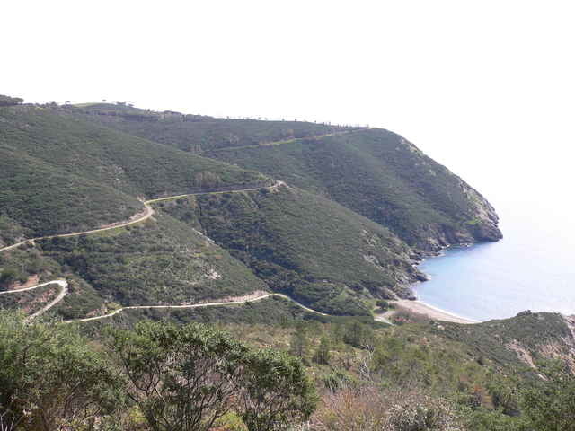
Diese Tour beginnt sehr einfach, fast 10 km nur auf einer Höhenebene. An der berühmten Mine vorbei teilweise über ehmalige WRC Moutainbikecupteilstrecken. Zurück einmal um den Magnetberg geht leicht bergab mit vielen kleinen Hügelchen über die man wenn mann möchte mit genug Gesschwindigkeit drüber Schanzen kann....hat sehr viel Spaß gemacht.
Viel Spaß.

Galeria trasy

Mapa trasy i profil wysokości

  • Open Street Map
  • Google
Minimum height -9 m Maximum height 362 m Widok szczegółowy

More about the tour author

MausMicky

Komentarze

Startpunkt in Capoliveri am Parkplatz ganz oben in der Stadt neben dem Resturant.

GPS tracks

Trackpoints
  • GPX / Garmin Map Source (gpx) download
  • TCX / Garmin Training Center® (tcx) download
  • CRS / Garmin Training Center® (crs) download
  • Google Earth (kml) download
  • G7ToWin (g7t) download
  • TTQV (trk) download
  • Overlay (ovl) download
  • Fugawi (txt) download
  • Kompass (DAV) Track (tk) download
  • Karta trasy (pdf) download
  • Original file of the author (gpx) download

More about the tour author

MausMicky

Share track
Add to my favorites
Remove from my favorites
Edit tags
My score
Rate
Trasa: Monte Calamita
Rodzaj: Rower górski (MTB)
Długość: 32,4 km
Evaluated on:
Czas trwania:
Day(s)
Hour(s)
Minute(s)
Ocena: Krajobraz Czynnik zadowolenia Kondycja Technika