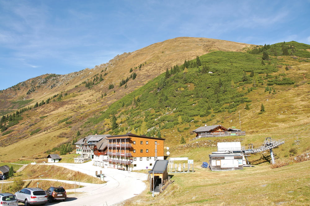
Vom Parkplatz in der Nähe des Hotels Tauernhaus 1.588m wandern wir die ersten 1,6 km dem Weg Nr. 17 folgend auf dem steilen Südhang zuerst hinauf bis zum Graskamm 2.032m.
Hier kannst du bei trockenem Untergrund auch einen kurzen Abstecher nach links zu den beiden Gstemmerspitzen machen. Doch Vorsicht, denn die Wanderung zu den beiden Gstemmerspitzen ist nur bei trockenem Boden empfehlenswert, da der Wanderweg im steilen Gelände sehr schmal ist und daneben sehr viel Gras wächst. Leider hat es in den vergangenen Jahren ein paar tödliche Bergunfälle gegeben, wo Wanderer auf dem nassen Gras ausgerutscht und abgestürzt sind.
Auf dem sanft steigenden und abfallenden Grasgrat wandern wir dann ca. 1,2 km weit über die Plannerseekarspitze 2.072m nach Osten bis zum Plannerknot 1.996m. Der Hochrettelstein liegt vom Plannerknot 1,7 km weiter in nordöstlicher Richtung. Bis zum abschließenden Anstieg auf den Gipfel des Hochrettelstein ist der stellenweise schmale Wanderweg, der einige Meter unterhalb des Bergkamms angelegt wurde, am Anfang nur leicht ansteigend und dann sogar etwas abfallend. Nach 4,5 km stehen wir auf dem Gipfel des 2.220m hohen Hochrettelsteins. Dabei haben wir auf den letzten 600m ein wenig mehr als 200 Höhenmeter überwunden was einer durchschnittlichen Steigung von ca. 34% entspricht. Der Gipfelbereich bietet viel Platz für eine gemütliche Pause mit herrlicher Rundumsicht.
weitere Infos und Fotos findest du auf biketours4you.at
From the parking lot near the hotel Tauernhaus 1.588m we walk the first 1.6 km on the hiking trail no. 17, the steep southern slopes following up to the saddle - Graskamm 2.032m.
Here you can also take a short detour to the left. But be very careful, because the hike to the two summits - Gstemmerspitzen is only recommended on a dry ground, because the walking path in this steep terrain is very narrow and next to it is a lot of grass. There was some fatal accidents in recent years, where hikers are slipped and crashed down on the wet grass.
On the gently rising and falling ridge we walk about 1.2 km beyond the first summit - Plannerseekarspitze 2.072m east to the junction - Plannerknot 1.996m. The second summit - Hochrettelstein is from the Plannerknot 1.7 km further to the northeast. Until the final climb up to the summit the narrow trail was created a few meters below the ridge and is at the beginning slightly uphill and then even slightly downhill. After 4.5 km we are on the top of the 2.220m high Hochrettelstein. On the last 600m we have overcome a little more than 200 vertical meters. The summit area offers a very good view. From the top you walk the same trail back to Plannerknot and continue in a long uphill and downhill section to the summits Plannereck 2.003m, Kleiner Rotbühel 1.866m and Großer Rotbühel 2.019m to the saddle – Gläserboden. Next we hike to the hill – Gläserkoppe and Jochspitze 2.037m to the next saddle Goldbachscharte. The marked trail leads us now 800m further westward to the mountain - Karlspitze 2.097m. Those hikers who have not enough with this seven summits can even hike 6 kilometers more to the both neighboring mountains Schoberspitze 2.126m and Schreinl. Finally, we follow the same trail back down to the saddle – Goldbachscharte and then on the hiking trail no. 902 to the starting point on the Planneralm.
Galeria trasy
Mapa trasy i profil wysokości
Komentarze

Ausgangspunkt: Planneralm (1588m)
GPS tracks
Trackpoints-
GPX / Garmin Map Source (gpx) download
-
TCX / Garmin Training Center® (tcx) download
-
CRS / Garmin Training Center® (crs) download
-
Google Earth (kml) download
-
G7ToWin (g7t) download
-
TTQV (trk) download
-
Overlay (ovl) download
-
Fugawi (txt) download
-
Kompass (DAV) Track (tk) download
-
Karta trasy (pdf) download
-
Original file of the author (gpx) download


