

Türkei - ein traumhaftes Bikerevier. Nur leider haben die Verantwortlichen die All Inklusive Hotels NICHT an den Bikestrecken gebaut. Für Biker die ohne Ballermann leben können.
Mehr Info unter http://www.lykienbiker.de
Auch unser Mailservice gibt Auskunft.
--------------------------------------------------------
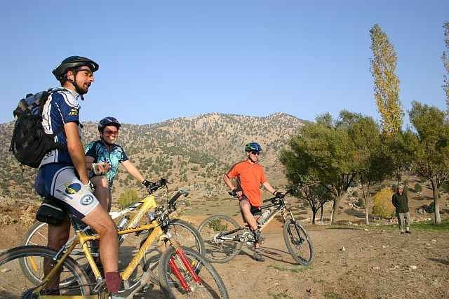
Knackiger Anstieg (Neuerdings durch einen Asphaltbelag etwas entschaerft - Steigung gleich, Verkehrsaufkommen wie seit eh und je = 0,5 auf einer Skala bis 10, bei erreichen des höchsten Punktes dieser Tour links weg ende des Asphaltbandes. Schöne Abfahrt bis Talsohle dann kletterei - Pass - Abfahrt - Hochebene - Pass...., Quellen mit sehr gutem Trinkwasser!
Konditionell mittelmaessig ->> anspruchsvoll, fahrtechnisch nicht sehr anspruchsvoll.
Mehr Info unter http://www.lykienbiker.de
Auch unser Mailservice gibt Auskunft.
--------------------------------------------------------
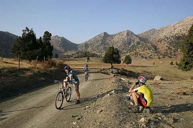
Knackiger Anstieg (Neuerdings durch einen Asphaltbelag etwas entschaerft - Steigung gleich, Verkehrsaufkommen wie seit eh und je = 0,5 auf einer Skala bis 10, bei erreichen des höchsten Punktes dieser Tour links weg ende des Asphaltbandes. Schöne Abfahrt bis Talsohle dann kletterei - Pass - Abfahrt - Hochebene - Pass...., Quellen mit sehr gutem Trinkwasser!
Konditionell mittelmaessig ->> anspruchsvoll, fahrtechnisch nicht sehr anspruchsvoll.
Further information at
http://www.lykienbiker.deGaleria trasy
Mapa trasy i profil wysokości
Minimum height 1011 m
Maximum height 1734 m
More about the tour author
|
|
lykienbiker |
Komentarze

Bus bis ELMALI dann auf Asphaltstrasse bis YUVA.
Oder: http://www.lykienbiker.de Bike&Bed buchen
Oder: http://www.lykienbiker.de Bike&Bed buchen
GPS tracks
Trackpoints-
GPX / Garmin Map Source (gpx) download
-
TCX / Garmin Training Center® (tcx) download
-
CRS / Garmin Training Center® (crs) download
-
Google Earth (kml) download
-
G7ToWin (g7t) download
-
TTQV (trk) download
-
Overlay (ovl) download
-
Fugawi (txt) download
-
Kompass (DAV) Track (tk) download
-
Karta trasy (pdf) download
-
Original file of the author (gpx) download
More about the tour author
|
|
lykienbiker |
Add to my favorites
Remove from my favorites
Edit tags
Open track
My score
Rate