Login

Zapomniałeś swój login?

Cookies have to be accepted!
Your browser's cookie functionality is disabled. Please enable this functionality.

Not a member yet?

Register now
Login

Available for registred users only

Log in to use this feature.

Zapomniałeś swój login?

Cookies have to be accepted!
Your browser's cookie functionality is disabled. Please enable this functionality.

Not a member yet?

Register now
Filter
Kategorie
Advanced filters
  • Długość (km)
  • Wysokość
Zapisz filtr Reset filter

TrackRank

QRCode

Technical data

Długość9,0 km Wysokość880 m Way down893 m Czas trwania03:19 h:m Data21.07.2015
Oceny Author Krajobraz Czynnik zadowolenia Kondycja Technika

Statystyka

266 Widoki Oceny 39 Downloads / Pliki do pobrania Przeciętnie
Rate
  • Karta trasy
  • Dojazd
  • Downloads / Pliki do pobrania

Stallila oberhalb von St Johann ist der Startpunkt. Von dort geht man den Putzweg bis zur Kegelgasslalm und dann weiter auf den Kreuzkofel.( auf den Gipfel muss man Trittsicher sein)

Den" Faden" so heisst der Weg, geht es dann Bergab bis zum Ausgangspunkt.
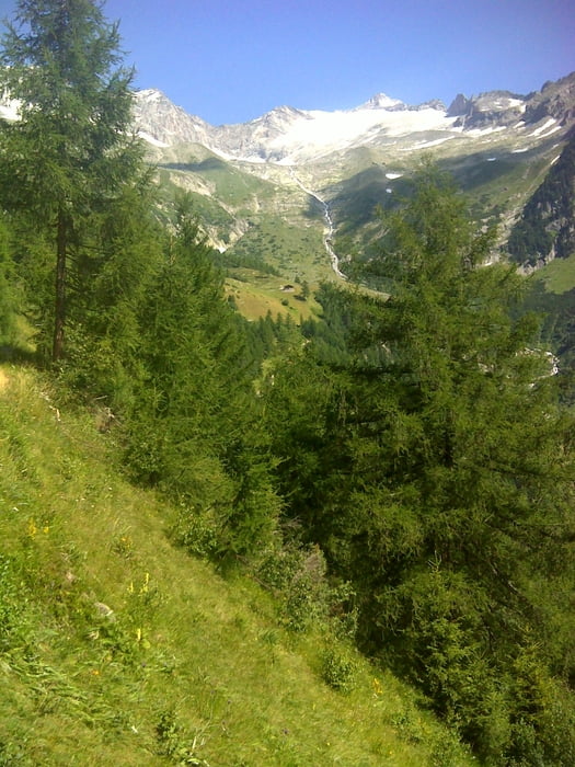
 

Galeria trasy

Mapa trasy i profil wysokości

  • Open Street Map
  • Google
Minimum height 1468 m Maximum height 2414 m Widok szczegółowy

More about the tour author

SuchdenFlow
Member since 2011

Send private message

Komentarze

Von St Johann zum Berggasthof Stallila mit dem Auto, Achtung es gibt wenig Parkplätze da viele Bergtouren von dort weggehen.


GPS tracks

Trackpoints
  • GPX / Garmin Map Source (gpx) download
  • TCX / Garmin Training Center® (tcx) download
  • CRS / Garmin Training Center® (crs) download
  • Google Earth (kml) download
  • G7ToWin (g7t) download
  • TTQV (trk) download
  • Overlay (ovl) download
  • Fugawi (txt) download
  • Kompass (DAV) Track (tk) download
  • Karta trasy (pdf) download
  • Original file of the author (gpx) download

More about the tour author

SuchdenFlow
Member since 2011

Send private message
Share track
Add to my favorites
Remove from my favorites
Edit tags
My score
Rate
Trasa: Kreuzkofel
Rodzaj: Wędrówki
Długość: 9,0 km
Evaluated on:
Czas trwania:
Day(s)
Hour(s)
Minute(s)
Ocena: Krajobraz Czynnik zadowolenia Kondycja Technika