Login

Zapomniałeś swój login?

Cookies have to be accepted!
Your browser's cookie functionality is disabled. Please enable this functionality.

Not a member yet?

Register now
Login

Available for registred users only

Log in to use this feature.

Zapomniałeś swój login?

Cookies have to be accepted!
Your browser's cookie functionality is disabled. Please enable this functionality.

Not a member yet?

Register now
Filter
Kategorie
Advanced filters
  • Długość (km)
  • Wysokość
Zapisz filtr Reset filter

TrackRank

QRCode

Technical data

Długość63,2 km Wysokość1232 m Way down1228 m Czas trwania00:00 h:m Data31.08.2015
Oceny Author Krajobraz Czynnik zadowolenia Kondycja Technika

Statystyka

397 Widoki Oceny 64 Downloads / Pliki do pobrania Przeciętnie
Rate
  • Karta trasy
  • Dojazd
  • Downloads / Pliki do pobrania

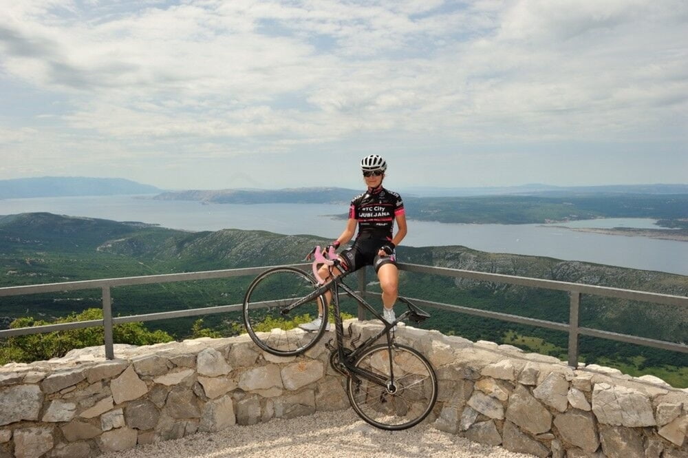
Jedna malo zahtjevnija ruta s obzirom na visinski profil i penjanje od skoro 1.300 metara no ruta koju svakako vrijedi doživjeti. Kreće iz Njivica i prelaskom Krčkog mosta kreće u unutrašnjost i zaleđe Crikvenice te se penje na skoro 800 metara nadmorske visine i vodi kroz seriju vidikovaca nazvanih "Oči vinodola". Povratak je uz Tribaljsko jezero i preko Krčkog mosta ponovno nazad u Njivice.

A somewhat more demanding route considering the height altitude and ascent to almost 1 300 meters, but one you should definitely experience. It starts from Njivice and passes over the Krk Bridge (Krčki most) into the inland and hinterland of Crikvenica and ascends to almost 800 meters above the sea level. It leads through a series of belvederes named "The Eyes of Vinodol". You return next to Tribalj Lake and over the Krk Bridge back to Njivice.

www.adriabike.hr
www.njiviceresort.com


Galeria trasy

Mapa trasy i profil wysokości

  • Open Street Map
  • Google
Minimum height 8 m Maximum height 777 m Widok szczegółowy

More about the tour author

AdriaBikeHotels
Member since 2014

Send private message

Komentarze

GPS tracks

Trackpoints
  • GPX / Garmin Map Source (gpx) download
  • TCX / Garmin Training Center® (tcx) download
  • CRS / Garmin Training Center® (crs) download
  • Google Earth (kml) download
  • G7ToWin (g7t) download
  • TTQV (trk) download
  • Overlay (ovl) download
  • Fugawi (txt) download
  • Kompass (DAV) Track (tk) download
  • Karta trasy (pdf) download
  • Original file of the author (gpx) download

More about the tour author

AdriaBikeHotels
Member since 2014

Send private message
Share track
Add to my favorites
Remove from my favorites
Edit tags
My score
Rate
Trasa: ROAD NJIVICE no.5.
Rodzaj: Rower szosowy
Długość: 63,2 km
Evaluated on:
Czas trwania:
Day(s)
Hour(s)
Minute(s)
Ocena: Krajobraz Czynnik zadowolenia Kondycja Technika