
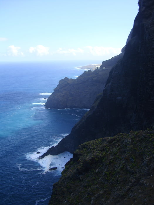

Tag 5: Buenavista del Norte - Punta del Teno
Wir fahren über eine sehr schöne und spektakuläre Asphaltstraße mit unseren Bikes von Buenavista del Norte bis zur Punta del Teno zum Schnorcheln. Es ist landschaftlich ein wunderbarer Abschnitt, bei dem man das Gebirge des Teno vor sich hat. An der Punta del Teno finden wir linksseitig eine ruhige Bucht, bei der man ohne einer großen Strömung gut schwimmen und schnorcheln kann. Bei unserem Schnorchelgang sehen wir u.a. auch Gelbmaul-Barrakudas. Am Abend fahren wir wieder auf der gleichen Straße zurück nach Buenavista del Norte. Achtung: Es gibt auf dieser Strecke zwei Tunnelabschnitte, wo es ratsam ist, wenn man ein Licht bei sich hat.
Galeria trasy


Mapa trasy i profil wysokości
Minimum height 2 m
Maximum height 338 m
More about the tour author
|
|
Markbeate |
Komentarze

Wir waren 3 Wochen - von Ende September bis Mitte Oktober 2015 - mit unseren MTB´s (Hardtails) auf 4 Kanarische Inseln unterwegs (Teneriffa, Lanzarote, La Graciosa und La Gomera).
GPS tracks
Trackpoints-
GPX / Garmin Map Source (gpx) download
-
TCX / Garmin Training Center® (tcx) download
-
CRS / Garmin Training Center® (crs) download
-
Google Earth (kml) download
-
G7ToWin (g7t) download
-
TTQV (trk) download
-
Overlay (ovl) download
-
Fugawi (txt) download
-
Kompass (DAV) Track (tk) download
-
Karta trasy (pdf) download
-
Original file of the author (gpx) download
More about the tour author
|
|
Markbeate |
Add to my favorites
Remove from my favorites
Edit tags
Open track
My score
Rate