Login

Zapomniałeś swój login?

Cookies have to be accepted!
Your browser's cookie functionality is disabled. Please enable this functionality.

Not a member yet?

Register now
Login

Available for registred users only

Log in to use this feature.

Zapomniałeś swój login?

Cookies have to be accepted!
Your browser's cookie functionality is disabled. Please enable this functionality.

Not a member yet?

Register now
Filter
Kategorie
Advanced filters
  • Długość (km)
  • Wysokość
Zapisz filtr Reset filter

TrackRank

QRCode

Technical data

Długość33,0 km Wysokość1155 m Way down1066 m Czas trwania03:30 h:m Data10.11.2015
Oceny Author Krajobraz Czynnik zadowolenia Kondycja Technika

Statystyka

615 Widoki Oceny 99 Downloads / Pliki do pobrania Przeciętnie
Rate
  • Karta trasy
  • Dojazd
  • Downloads / Pliki do pobrania
  • Start/Ziel: Eyrs-Parkplatz
  • Rundkurs im Uhrzeigersinn
  • Von Eyrs auf dem Radweg nach Schluderns. Ca. 300 Meter steiler Aufstieg auf Karrenweg zur Churburg. Von dort auf Teerstrasse zum Platzassboden. Auf Steig- bzw. Waldweg Obertels. Mittelsteiler Aufstieg auf Waldweg nach Oberfrini (KM 24 - MH 1.738). Abfahrt auf Teer Richtung Tanas. Ab Tanas auf Forstweg hinunter ins Tal zurück zum Ausgangspunkt, nach Eyrs.
  • Einige kurze Schiebepassagen.
  • Technische Schwierigkeit: S0-S1.
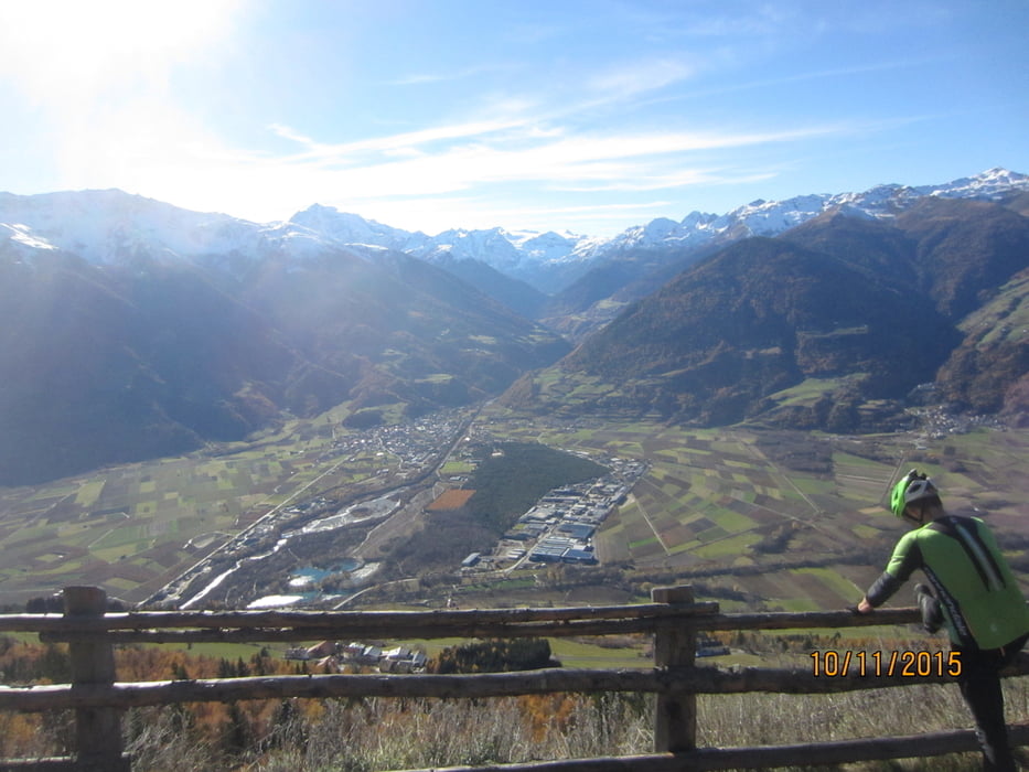
Galeria trasy

Mapa trasy i profil wysokości

  • Open Street Map
  • Google
Minimum height 824 m Maximum height 1749 m Widok szczegółowy

More about the tour author

MargesinFriedrich
Member since 2012

Send private message

Komentarze

GPS tracks

Trackpoints
  • GPX / Garmin Map Source (gpx) download
  • TCX / Garmin Training Center® (tcx) download
  • CRS / Garmin Training Center® (crs) download
  • Google Earth (kml) download
  • G7ToWin (g7t) download
  • TTQV (trk) download
  • Overlay (ovl) download
  • Fugawi (txt) download
  • Kompass (DAV) Track (tk) download
  • Karta trasy (pdf) download
  • Original file of the author (gpx) download

More about the tour author

MargesinFriedrich
Member since 2012

Send private message
Share track
Add to my favorites
Remove from my favorites
Edit tags
My score
Rate
Trasa: Schludernser Sonnenberg Tour v. Eyrs
Rodzaj: Rower górski (MTB)
Długość: 33,0 km
Evaluated on:
Czas trwania:
Day(s)
Hour(s)
Minute(s)
Ocena: Krajobraz Czynnik zadowolenia Kondycja Technika