


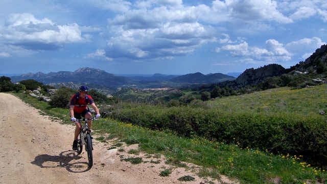
Relativ kurze Runde um den Monte Santo. Überwiegend auf gut befahrbaren Wegen. Viele reizvolle Ausblicke und ein schöner Schotter-Downhill in vielen Serpentinen zurück ins Tal. Nach leichtem Beginn folgt ein kurzer steiler Abschnitt auf einem ausgewaschenen Schotterweg. Danach wieder Asphalt bis zur Kapelle San Giacomo. Nach kurzer Abfahrt geht es dann auf Schotter relativ steil hoch zu einem Sattel und mit einem kurzen Gegenanstieg wieder hinab zum Startpunkt. Die Tour ließe sich gut mit einer Umrundung des Monte Pino erweitern. Bei uns hat dies ein Gewitter leider verhindert.
Galeria trasy
Mapa trasy i profil wysokości
Minimum height 78 m
Maximum height 500 m
More about the tour author
|
|
hahnilein |
Komentarze

Von Olbia auf der SS 125 Richtung Arzachana fahren. In einer Rechtskurve nach links auf eine kleine Asphaltstrasse abbiegen und Schildern Richtung Agriturismo Aldareddu folgen. Nach ca. 2 km bei der Brücke über einen Bach parken.
GPS tracks
Trackpoints-
GPX / Garmin Map Source (gpx) download
-
TCX / Garmin Training Center® (tcx) download
-
CRS / Garmin Training Center® (crs) download
-
Google Earth (kml) download
-
G7ToWin (g7t) download
-
TTQV (trk) download
-
Overlay (ovl) download
-
Fugawi (txt) download
-
Kompass (DAV) Track (tk) download
-
Karta trasy (pdf) download
-
Original file of the author (gpx) download
More about the tour author
|
|
hahnilein |
Add to my favorites
Remove from my favorites
Edit tags
Open track
My score
Rate