
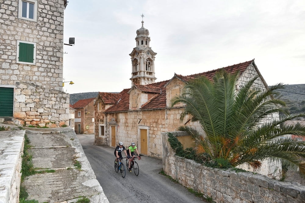

Ova staza nudi uvid u lokalna mjesta i prolazi nekima od važnijih turističkih mjesta na otoku Braču, uz pogled na brački kanal i grad Split. Staza nije fizički prezahtjevna pa je namijenjena biciklistima osnovne fizičke spremnosti, željnima laganije vožnje s lijepim pejzažima u neposrednoj blizini mora.
This track offers insight into local settlements and passes through several more important tourist places on Brač island, with a view over the Brač Canal and the city of Split. The track is not physically too demanding and therefore it is intended for cyclists in basic physical condition, who want to experience an easier ride with beautiful landscapes in the immediate vicinity of the sea.
Galeria trasy


Mapa trasy i profil wysokości
Minimum height -2 m
Maximum height 401 m
More about the tour author
|
|
AdriaBikeHotels |
Komentarze

GPS tracks
Trackpoints-
GPX / Garmin Map Source (gpx) download
-
TCX / Garmin Training Center® (tcx) download
-
CRS / Garmin Training Center® (crs) download
-
Google Earth (kml) download
-
G7ToWin (g7t) download
-
TTQV (trk) download
-
Overlay (ovl) download
-
Fugawi (txt) download
-
Kompass (DAV) Track (tk) download
-
Karta trasy (pdf) download
-
Original file of the author (gpx) download
More about the tour author
|
|
AdriaBikeHotels |
Add to my favorites
Remove from my favorites
Edit tags
Open track
My score
Rate