Login

Zapomniałeś swój login?

Cookies have to be accepted!
Your browser's cookie functionality is disabled. Please enable this functionality.

Not a member yet?

Register now
Login

Available for registred users only

Log in to use this feature.

Zapomniałeś swój login?

Cookies have to be accepted!
Your browser's cookie functionality is disabled. Please enable this functionality.

Not a member yet?

Register now
Filter
Kategorie
Advanced filters
  • Długość (km)
  • Wysokość
Zapisz filtr Reset filter

TrackRank

QRCode

Technical data

Długość4,4 km Wysokość71 m Way down39 m Czas trwania01:30 h:m Data22.04.2008
Oceny Author User Krajobraz Czynnik zadowolenia Kondycja Technika

Statystyka

613 Widoki 1 Ocena 118 Downloads / Pliki do pobrania 3.00 Przeciętnie
Rate
  • Karta trasy
  • Dojazd
  • Downloads / Pliki do pobrania
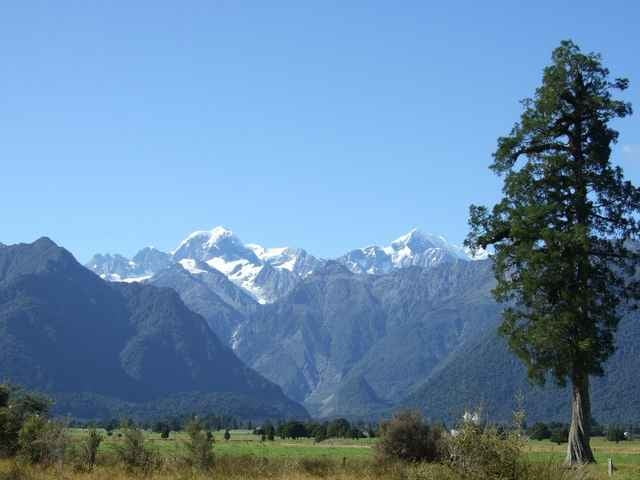
Vom Parkplatz zum Lake Matheson und drum herum. Solange keine Wasser- oder Spassvögel die Seeoberfläche kräuseln, hat man ein tolles Spiegelbild von Mount Tasman und Aoraki / Mount Cook im See.

Further information at

http://www.doc.govt.nz/templates/trackandwalk.aspx?id=36431

Galeria trasy

Mapa trasy i profil wysokości

  • Open Street Map
  • Google
Minimum height 98 m Maximum height 155 m Widok szczegółowy

More about the tour author

Lutz
Member since 2007

Send private message

Komentarze

State Highway 6 bei Fox Glacier abbiegen, Fünf Kilometer der Cook Flat Road folgen. Die Lake Mathesons Abbiegung ist ausgeschildert.

GPS tracks

Trackpoints
  • GPX / Garmin Map Source (gpx) download
  • TCX / Garmin Training Center® (tcx) download
  • CRS / Garmin Training Center® (crs) download
  • Google Earth (kml) download
  • G7ToWin (g7t) download
  • TTQV (trk) download
  • Overlay (ovl) download
  • Fugawi (txt) download
  • Kompass (DAV) Track (tk) download
  • Karta trasy (pdf) download
  • Original file of the author (gpx) download

More about the tour author

Lutz
Member since 2007

Send private message
Share track
Add to my favorites
Remove from my favorites
Edit tags
My score
Rate
Trasa: Lake Matheson
Rodzaj: Wędrówki
Długość: 4,4 km
Evaluated on:
Czas trwania:
Day(s)
Hour(s)
Minute(s)
Ocena: Krajobraz Czynnik zadowolenia Kondycja Technika