
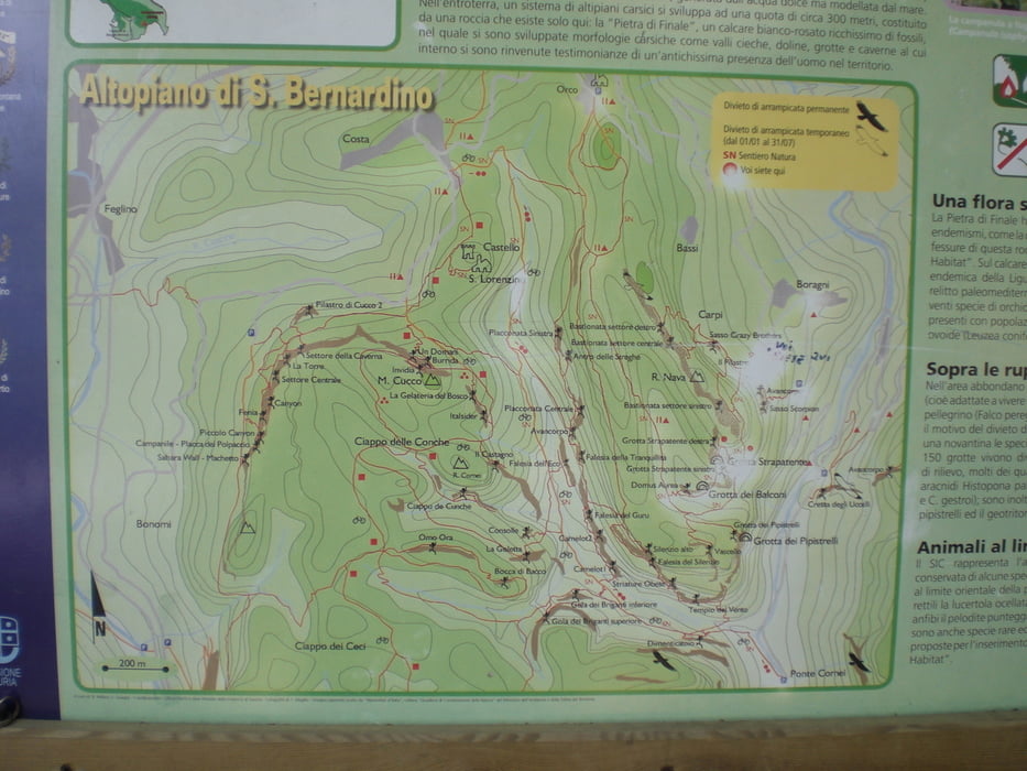

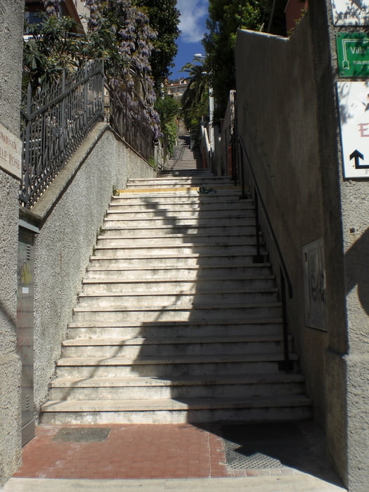
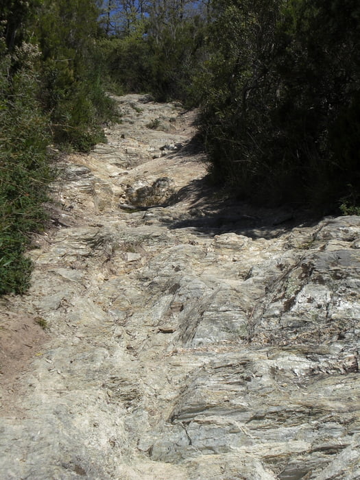
vom Camping Tahit hinauf (Aspahlt) nach San Berndino. Bei einem Rastplatz geht ein S2-trail hinab nach Finale. In Finale gehts bis in die Altstadt eine ca. 500 m lange Treppe runter. Ab hier hinauf Richtung Le Manie (Aspahlt). Links ab in den Briga-Trail. Dieser teilt sich. Ich bin rechts gefahren. Erst S1 - S2 dann S0 am Hang entlang. In Finalpina kommt man wieder raus. Von hier über Calvisio nach Boragni. In Boragni links weg auf einem Trail hoch. Leider sind ein paar Schiebestücke drin. In Orco kommt man raus. Dann auf einem Fahrweg wieder hinab. Ich habe gedacht, das geht da bisschen spektakulärer runter. Auf der Strasse zurück zum Camping
Galeria trasy
Mapa trasy i profil wysokości
Minimum height -26 m
Maximum height 388 m
More about the tour author
|
|
Fruehaufsteher |
Komentarze

GPS tracks
Trackpoints-
GPX / Garmin Map Source (gpx) download
-
TCX / Garmin Training Center® (tcx) download
-
CRS / Garmin Training Center® (crs) download
-
Google Earth (kml) download
-
G7ToWin (g7t) download
-
TTQV (trk) download
-
Overlay (ovl) download
-
Fugawi (txt) download
-
Kompass (DAV) Track (tk) download
-
Karta trasy (pdf) download
-
Original file of the author (gpx) download
More about the tour author
|
|
Fruehaufsteher |
Add to my favorites
Remove from my favorites
Edit tags
Open track
My score
Rate