Login

Zapomniałeś swój login?

Cookies have to be accepted!
Your browser's cookie functionality is disabled. Please enable this functionality.

Not a member yet?

Register now
Login

Available for registred users only

Log in to use this feature.

Zapomniałeś swój login?

Cookies have to be accepted!
Your browser's cookie functionality is disabled. Please enable this functionality.

Not a member yet?

Register now
Filter
Kategorie
Advanced filters
  • Długość (km)
  • Wysokość
Zapisz filtr Reset filter

TrackRank

QRCode

Technical data

Długość25,1 km Wysokość697 m Way down697 m Czas trwania03:00 h:m Data16.05.2016
Oceny Author User Krajobraz Czynnik zadowolenia Kondycja Technika

Statystyka

723 Widoki 3 Oceny 103 Downloads / Pliki do pobrania 3.67 Przeciętnie
Rate
  • Karta trasy
  • Dojazd
  • Downloads / Pliki do pobrania

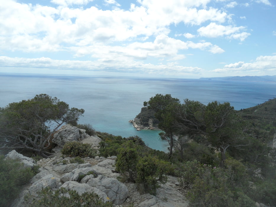
Endurorunde auf der Manie, S1-S2+, die Abfahrt nach Varagotti ist sehr schwer S3+ (100m), habe auch etwas runter geschoben. Enduro heißt auch bergauf Trails, meist fahrbar entsprechend der Kondition.


Mapa trasy i profil wysokości

  • Open Street Map
  • Google
Minimum height 3 m Maximum height 376 m Widok szczegółowy

More about the tour author

skyhopper
Member since 2005

Send private message

Komentarze

GPS tracks

Trackpoints
  • GPX / Garmin Map Source (gpx) download
  • TCX / Garmin Training Center® (tcx) download
  • CRS / Garmin Training Center® (crs) download
  • Google Earth (kml) download
  • G7ToWin (g7t) download
  • TTQV (trk) download
  • Overlay (ovl) download
  • Fugawi (txt) download
  • Kompass (DAV) Track (tk) download
  • Karta trasy (pdf) download
  • Original file of the author (gpx) download

More about the tour author

skyhopper
Member since 2005

Send private message
Share track
Add to my favorites
Remove from my favorites
Edit tags
My score
Rate
Trasa: Finale Ligure Manierunde 2016
Rodzaj: Rower górski (MTB)
Długość: 25,1 km
Evaluated on:
Czas trwania:
Day(s)
Hour(s)
Minute(s)
Ocena: Krajobraz Czynnik zadowolenia Kondycja Technika