Login

Zapomniałeś swój login?

Cookies have to be accepted!
Your browser's cookie functionality is disabled. Please enable this functionality.

Not a member yet?

Register now
Login

Available for registred users only

Log in to use this feature.

Zapomniałeś swój login?

Cookies have to be accepted!
Your browser's cookie functionality is disabled. Please enable this functionality.

Not a member yet?

Register now
Filter
Kategorie
Advanced filters
  • Długość (km)
  • Wysokość
Zapisz filtr Reset filter

TrackRank

QRCode

Technical data

Długość17,3 km Wysokość364 m Way down366 m Czas trwania04:30 h:m Data30.05.2016
Oceny Author Krajobraz Czynnik zadowolenia Kondycja Technika

Statystyka

257 Widoki Oceny 25 Downloads / Pliki do pobrania Przeciętnie
Rate
  • Karta trasy
  • Dojazd
  • Downloads / Pliki do pobrania
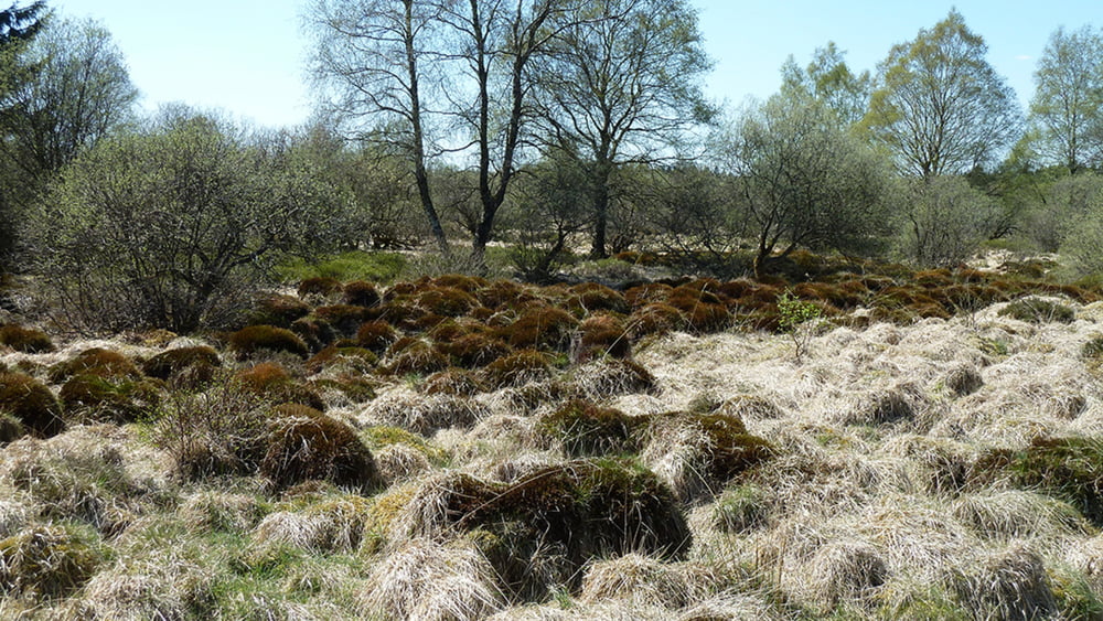
Das Auge verliert sich in den Weiten des Naturparks Hohes Venn. Eine unendliche Ruhe geht von diesem Hochmoor aus. Die Hecken am Wegesrand sind mit Moosen und Flechten bedeckt, die Birken wiegen sich sanft im Wind, auf schmalen Holzstegen bahnt sich der Eifelsteig seinen Weg an der Grenze zu Belgien. Herrliche Fernsichten werden auf den nächsten Kilometern geboten.

Galeria trasy

Mapa trasy i profil wysokości

  • Open Street Map
  • Google
Minimum height 386 m Maximum height 662 m Widok szczegółowy

More about the tour author

schleidy
Member since 2013

Send private message

Komentarze

GPS tracks

Trackpoints
  • GPX / Garmin Map Source (gpx) download
  • TCX / Garmin Training Center® (tcx) download
  • CRS / Garmin Training Center® (crs) download
  • Google Earth (kml) download
  • G7ToWin (g7t) download
  • TTQV (trk) download
  • Overlay (ovl) download
  • Fugawi (txt) download
  • Kompass (DAV) Track (tk) download
  • Karta trasy (pdf) download
  • Original file of the author (gpx) download

More about the tour author

schleidy
Member since 2013

Send private message
Share track
Add to my favorites
Remove from my favorites
Edit tags
My score
Rate
Trasa: Der Eifelsteig, 2. Etappe. Monschau-Roetgen
Rodzaj: Wędrówki
Długość: 17,3 km
Evaluated on:
Czas trwania:
Day(s)
Hour(s)
Minute(s)
Ocena: Krajobraz Czynnik zadowolenia Kondycja Technika