


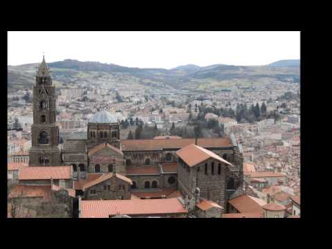
Blickfang der Stadt le Puy-en-Velay sind die Basaltkuppen (Puys), ehemalige Vulkanschlote. Auf der einen dieser beiden Kuppen thront die Kirche Saint-Michel d’Aiguilhe (heiliger Michael auf der Nadel). Sirenen mit Netzen als Symbole der Verführung.Auf dem benachbarten Vulkankegel, dem Rocher Corneille, steht die Statue der Notre–Dame de la France (Quelle: WIKIPEDIA).
Die Tour entspricht im wesentlich der Tour 29 Rother Wanderführer Auvergne Seite 90.
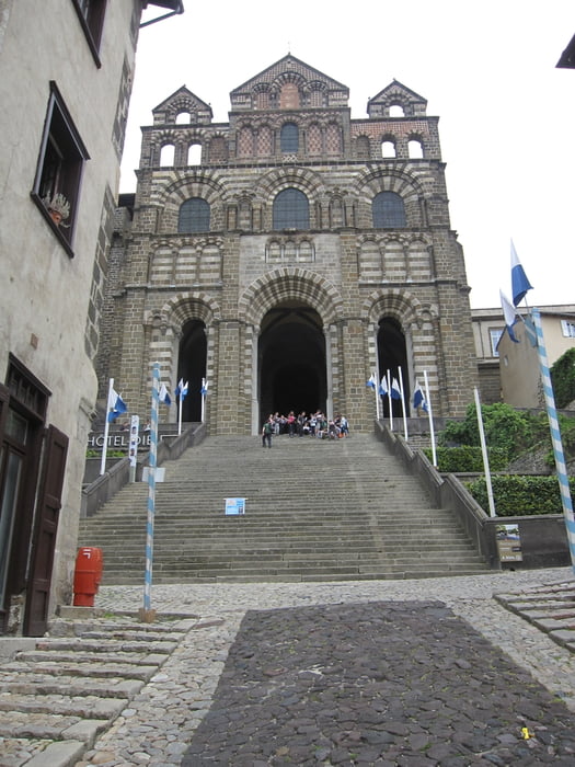
Der Originaltrack ist allerdings verlängert worden und schließt den Weg zu Cathédrale Notre-Dame Du Puy sowie der Statue Notre-Dame de France ein.
Further information at
https://www.facebook.com/dieter.drillich/media_set?set=a.1219272198085352.1073741845.100000077491153&type=3Galeria trasy


Mapa trasy i profil wysokości
Minimum height 620 m
Maximum height 890 m
More about the tour author
|
|
GPSDieter |
Komentarze

Der Ort Le Puy-en-Velay ist eine Zentrum der Region und deshalb von allen Richtungen kommend gut ausgeschildert. An der D13 Avenue de Bonneville in Höhe der Chapelle Saint Michel d'Aiguilhe (Kapelle auf dem Felsen) gibt es einen Parkplatz.
Oder geben Sie in Ihr Navigationsgeräte die GPS Koordinaten N45° 02' 59.4" E3° 52' 52.0" ein.
Hinweis:
Der Ort ist touristisch stark frequentiert. Sie müssen also u.U. nach einem Parkplatz suchen.
Weitere Bilder siehe Link weitere Informationen,
GPS tracks
Trackpoints-
GPX / Garmin Map Source (gpx) download
-
TCX / Garmin Training Center® (tcx) download
-
CRS / Garmin Training Center® (crs) download
-
Google Earth (kml) download
-
G7ToWin (g7t) download
-
TTQV (trk) download
-
Overlay (ovl) download
-
Fugawi (txt) download
-
Kompass (DAV) Track (tk) download
-
Karta trasy (pdf) download
-
Original file of the author (gpx) download
More about the tour author
|
|
GPSDieter |
Add to my favorites
Remove from my favorites
Edit tags
Open track
My score
Rate