


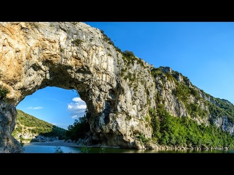
Der Pont d’Arc ist eine natürliche Steinbrücke über den Fluss Ardèche im Département Ardèche im Süden Frankreichs. Er ist 60 Meter lang, 54 Meter hoch und liegt etwa drei Kilometer entfernt von Vallon-Pont-d’Arc in Richtung Saint-Martin-d’Ardèche.
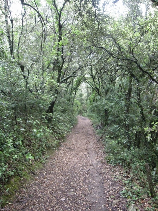
Die Wanderung startet direkt am Pont d’Arc - an der Auberge du Pont d’Arc. Von dort geht es ein kurzes Stück der Straße entlang und dann herunter zum Fluss Ardèche für einen ersten Blick auf den Pont d’Arc. Zurück über die Straße geht es bergauf zur Carverne du Pont d'Arc - einem Museum in die Höhlennachbildung der benachbarten Chauvet-Höhle (grotte Chauvet) besichtigen können.
Auf einer anderen Route kehren Sie zum du Pont d’Arc zurück. Gehen Sie nochmals herunter zum Ardeche und genießen den Ausblick auf den Pont d’Arc.
Eine ähnliche Tour ist in "Ardeche Frankreichs wilder Süden", Tour 22 Seite 80 zu finden.
Further information at
https://www.facebook.com/dieter.drillich/media_set?set=a.1220065721339333.1073741848.100000077491153&type=3Galeria trasy


Mapa trasy i profil wysokości
Minimum height 71 m
Maximum height 289 m
More about the tour author
|
|
GPSDieter |
Komentarze

Der Pont d'Arc liegt in der Gemeinde Vallon-Pont-d’Arc an der D290. An der Auberge du Pont d'Arc gibt es einen Parkplatz. Auf der gegenüberliegenden Seite ist der Pont d'Arc
Oder geben Sie in Ihr Navigationsgeräte die GPS Koordinaten N44° 23' 01.3" E4° 24' 48.6" ein.
Weitere Bilder siehe Link weitere Informationen.
GPS tracks
Trackpoints-
GPX / Garmin Map Source (gpx) download
-
TCX / Garmin Training Center® (tcx) download
-
CRS / Garmin Training Center® (crs) download
-
Google Earth (kml) download
-
G7ToWin (g7t) download
-
TTQV (trk) download
-
Overlay (ovl) download
-
Fugawi (txt) download
-
Kompass (DAV) Track (tk) download
-
Karta trasy (pdf) download
-
Original file of the author (gpx) download
More about the tour author
|
|
GPSDieter |
Add to my favorites
Remove from my favorites
Edit tags
Open track
My score
Rate