
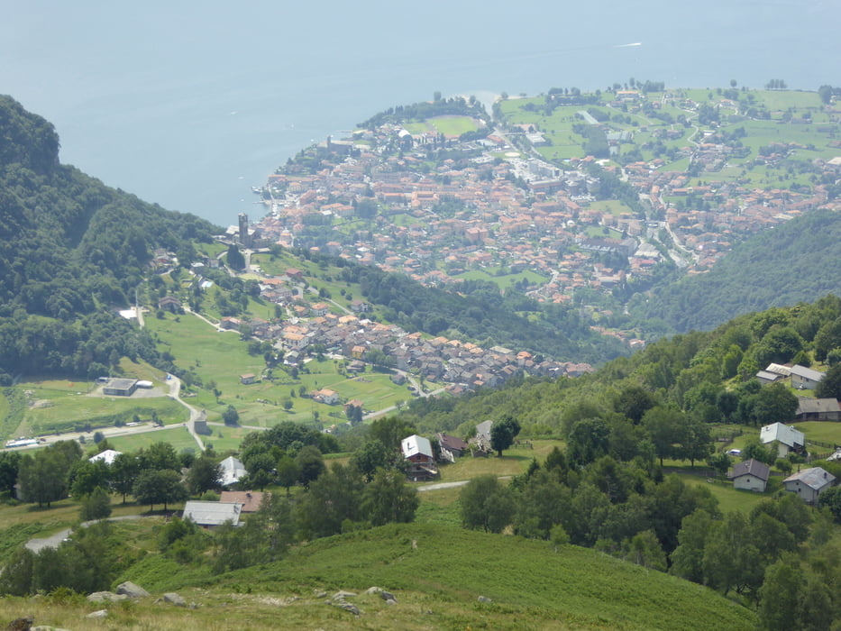

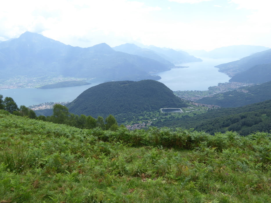
Die Tour beginnt im Ort Bodone auf dem Wanderparkplatz am Ende des Dorfes. Sie ist gekennzeichnet durch sehr schöne Tiefblicke auf Peglio, Livo und den See. Der Weg folgt zunächst steil in Serpentinen dem grasigen Rücken direkt oberhalb des Parkplatzes bis zum ersten Hügel mit Kreuz und der Alpe Bodone. Von dort auf gut sichtbaren Steigspuren und Markierung über den Kamm bis man auf den parallel links unterhalb verlaufenden Fahrweg stößt. Dort gäbe es die Möglichkeit den Anstieg bis zum Gipfel des Monte Duria fortzusetzen, was aber eine längere Wanderung bedeutet. Nun kann man auf dem Fahrweg zur Alpe zurück oder auf dem gleichen Weg bis oberhalb der Alm und dort sich links haltend zum Rifigio Colman. Von dort geht man auf einem gut ausgetretenen Pfad durch hohen Farn zurück zum Parkplatz.
Galeria trasy
Mapa trasy i profil wysokości
Minimum height 1150 m
Maximum height 1494 m
More about the tour author

|
Zohren |
Komentarze

Von Gravedona über Peglio bis zum Ortsausgang. An der Kapelle links abbiegen und bis zum Ortsende von Bodone fahren. Dort großzügiger Parkplatz mit Wasserstelle.
GPS tracks
Trackpoints-
GPX / Garmin Map Source (gpx) download
-
TCX / Garmin Training Center® (tcx) download
-
CRS / Garmin Training Center® (crs) download
-
Google Earth (kml) download
-
G7ToWin (g7t) download
-
TTQV (trk) download
-
Overlay (ovl) download
-
Fugawi (txt) download
-
Kompass (DAV) Track (tk) download
-
Karta trasy (pdf) download
-
Original file of the author (gpx) download
More about the tour author
|
|
Zohren |
Add to my favorites
Remove from my favorites
Edit tags
Open track
My score
Rate