Login

Zapomniałeś swój login?

Cookies have to be accepted!
Your browser's cookie functionality is disabled. Please enable this functionality.

Not a member yet?

Register now
Login

Available for registred users only

Log in to use this feature.

Zapomniałeś swój login?

Cookies have to be accepted!
Your browser's cookie functionality is disabled. Please enable this functionality.

Not a member yet?

Register now
Filter
Kategorie
Advanced filters
  • Długość (km)
  • Wysokość
Zapisz filtr Reset filter

TrackRank

QRCode

Technical data

Długość9,0 km Wysokość310 m Way down309 m Czas trwania00:00 h:m Data01.10.2016
Oceny Author Krajobraz Czynnik zadowolenia Kondycja Technika

Statystyka

1011 Widoki Oceny 22 Downloads / Pliki do pobrania Przeciętnie
Rate
  • Karta trasy
  • Dojazd
  • Downloads / Pliki do pobrania

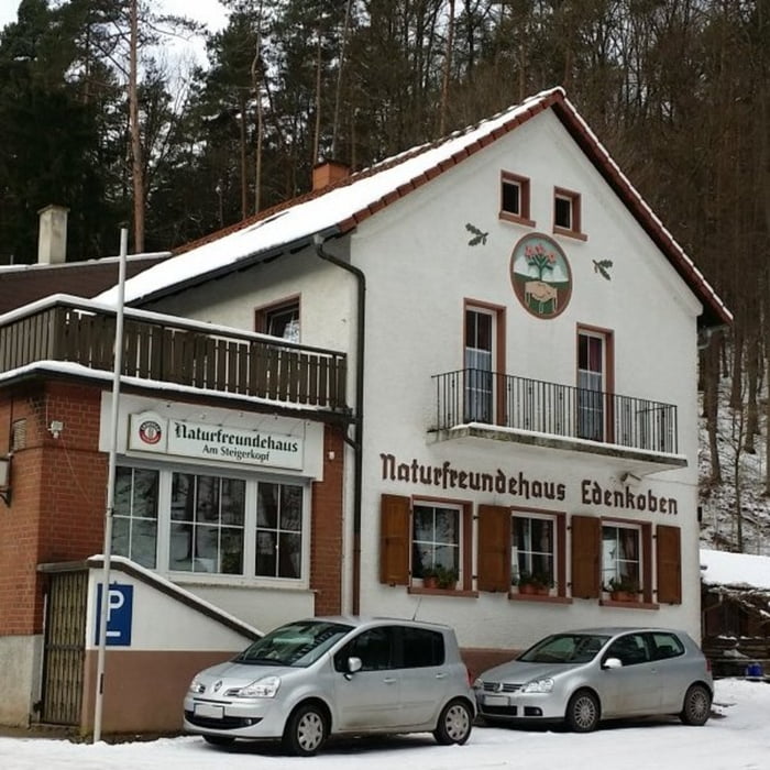
Vom Parkplatz unterhalb des Naturfreundehauses Edenkoben führt die Strecke entlang des Tiefenbachs zum Morschenberg und St. Martiner Hütte. Von dort geht es wieder zurück zum Naturfreundehaus Edenkoben.


Galeria trasy

Mapa trasy i profil wysokości

  • Open Street Map
  • Google
Minimum height 347 m Maximum height 623 m Widok szczegółowy

More about the tour author

isg13
Member since 2010

Send private message

Komentarze

GPS tracks

Trackpoints
  • GPX / Garmin Map Source (gpx) download
  • TCX / Garmin Training Center® (tcx) download
  • CRS / Garmin Training Center® (crs) download
  • Google Earth (kml) download
  • G7ToWin (g7t) download
  • TTQV (trk) download
  • Overlay (ovl) download
  • Fugawi (txt) download
  • Kompass (DAV) Track (tk) download
  • Karta trasy (pdf) download
  • Original file of the author (gpx) download

More about the tour author

isg13
Member since 2010

Send private message
Share track
Add to my favorites
Remove from my favorites
Edit tags
My score
Rate
Trasa: Pfälzer Rundwanderung mit Einkehr - Naturfreundehaus Edenkoben
Rodzaj: Wędrówki
Długość: 9,0 km
Evaluated on:
Czas trwania:
Day(s)
Hour(s)
Minute(s)
Ocena: Krajobraz Czynnik zadowolenia Kondycja Technika