


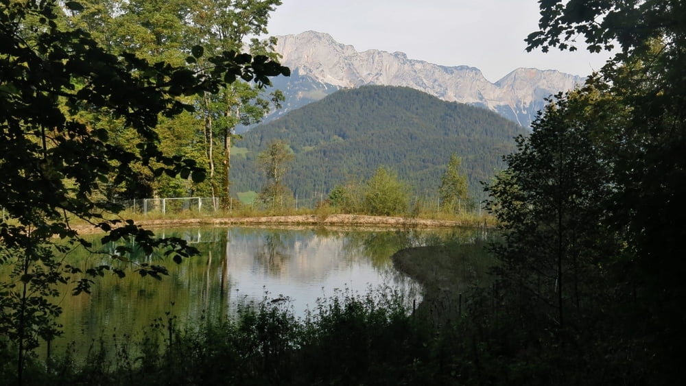
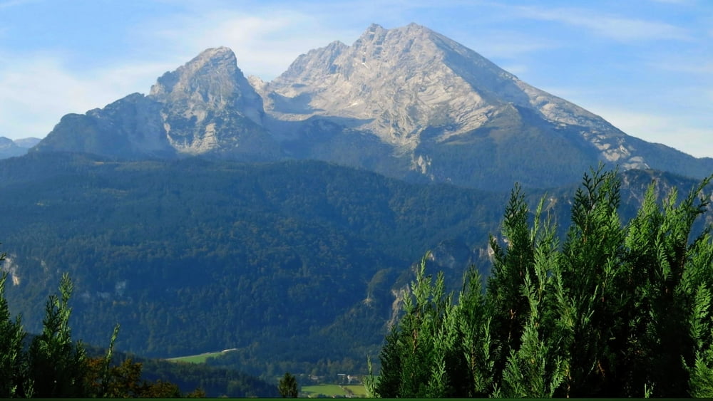
Wir folgen der Beschilderung "Carl- von- Linde- Weg" über Hochlenzer mit phantastischem Panoramablick zur Graflhöhe ("Windbeutelbaron")- wir erwischten leider den Ruhetag- Dienstag :-( . Von hier aus nehmen wir den nach halbrechts abzweigenden Weg zum Parkplatz an der Scharitzkehl- Straße und folgen dem "oberen" Weg zum Parkplatz.
HINWEIS zum Video:
Mit Mozilla Firefox und Flash- Player Plugin startet das Video direkt.
Andernfalls verwendet ihr in eurem Browser den Link:
Galeria trasy


Mapa trasy i profil wysokości
Minimum height 870 m
Maximum height 967 m
More about the tour author
|
|
heinz-57 |
Komentarze

Von Berchtesgaden zum Oberzalzberg. Gegenüber dem Dokumentationszentrum großes Schild mit Wegbeginn.
GPS tracks
Trackpoints-
GPX / Garmin Map Source (gpx) download
-
TCX / Garmin Training Center® (tcx) download
-
CRS / Garmin Training Center® (crs) download
-
Google Earth (kml) download
-
G7ToWin (g7t) download
-
TTQV (trk) download
-
Overlay (ovl) download
-
Fugawi (txt) download
-
Kompass (DAV) Track (tk) download
-
Karta trasy (pdf) download
-
Original file of the author (gpx) download
More about the tour author
|
|
heinz-57 |
Add to my favorites
Remove from my favorites
Edit tags
Open track
My score
Rate