Login

Zapomniałeś swój login?

Cookies have to be accepted!
Your browser's cookie functionality is disabled. Please enable this functionality.

Not a member yet?

Register now
Login

Available for registred users only

Log in to use this feature.

Zapomniałeś swój login?

Cookies have to be accepted!
Your browser's cookie functionality is disabled. Please enable this functionality.

Not a member yet?

Register now
Filter
Kategorie
Advanced filters
  • Długość (km)
  • Wysokość
Zapisz filtr Reset filter

TrackRank

QRCode

Technical data

Długość45,5 km Wysokość944 m Way down952 m Czas trwania02:50 h:m Data08.10.2016
Oceny Author Krajobraz Czynnik zadowolenia Kondycja Technika

Statystyka

655 Widoki Oceny 78 Downloads / Pliki do pobrania Przeciętnie
Rate
  • Karta trasy
  • Dojazd
  • Downloads / Pliki do pobrania

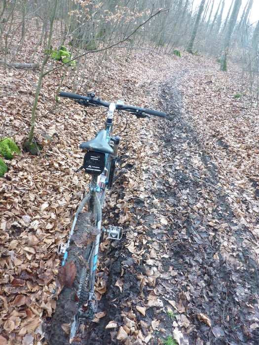
Aufgezeichnete Strecke vom Bike-Marathon in Güntersleben 2016 über die Mitteldistanz von 45 km. Aufgrund von anhaltenden Regenfälle sehr aufgeweichte Streckenabschnitte wodurch sonst gut fahrbare Abfahrten geschoben werden mussten. Sehr schöne Tour über Weinberge ins Maintal und zurück mit sehr hohem Singletrail-Anteil. Viele steile Anstiege, gute Kondition nötig um Spaß zu haben.


Galeria trasy

Mapa trasy i profil wysokości

  • Open Street Map
  • Google
Minimum height 171 m Maximum height 384 m Widok szczegółowy

More about the tour author

Lukas90
Member since 2016

Send private message

Komentarze

GPS tracks

Trackpoints
  • GPX / Garmin Map Source (gpx) download
  • TCX / Garmin Training Center® (tcx) download
  • CRS / Garmin Training Center® (crs) download
  • Google Earth (kml) download
  • G7ToWin (g7t) download
  • TTQV (trk) download
  • Overlay (ovl) download
  • Fugawi (txt) download
  • Kompass (DAV) Track (tk) download
  • Karta trasy (pdf) download
  • Original file of the author (gpx) download

More about the tour author

Lukas90
Member since 2016

Send private message
Share track
Add to my favorites
Remove from my favorites
Edit tags
My score
Rate
Trasa: Bike Marathon Güntersleben, Mittelstrecke 2016
Rodzaj: Rower górski (MTB)
Długość: 45,5 km
Evaluated on:
Czas trwania:
Day(s)
Hour(s)
Minute(s)
Ocena: Krajobraz Czynnik zadowolenia Kondycja Technika