Login

Zapomniałeś swój login?

Cookies have to be accepted!
Your browser's cookie functionality is disabled. Please enable this functionality.

Not a member yet?

Register now
Login

Available for registred users only

Log in to use this feature.

Zapomniałeś swój login?

Cookies have to be accepted!
Your browser's cookie functionality is disabled. Please enable this functionality.

Not a member yet?

Register now
Filter
Kategorie
Advanced filters
  • Długość (km)
  • Wysokość
Zapisz filtr Reset filter

TrackRank

QRCode

Technical data

Długość10,5 km Wysokość31 m Way down47 m Czas trwania02:15 h:m Data08.01.2017
Oceny Author Krajobraz Czynnik zadowolenia Kondycja Technika

Statystyka

301 Widoki Oceny 3 Downloads / Pliki do pobrania Przeciętnie
Rate
  • Karta trasy
  • Dojazd
  • Downloads / Pliki do pobrania

Wir wanderten zum Teltowkanal um an dessen nördlichen Ufer bis zum Tempelhofer Hafen am Kanal entlang zu wandern.

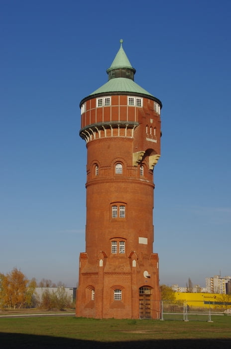
Auf der südlichen Seite bogen wir wieder nach Westen ein und besuchten das nun zugängliche Gelände mit den neu angesiedelten Firmen um das alte Gasometer und die Wassertürme.
Duch den alten Ortskern von Lankwitz suchten wir uns den Rückweg zum Ausagangspunkt.


Further information at

http://marienpark-berlin.com/de/

Galeria trasy

Mapa trasy i profil wysokości

  • Open Street Map
  • Google
Minimum height 26 m Maximum height 48 m Widok szczegółowy

More about the tour author

Pheinz
Member since 2009

Send private message

Komentarze

Start und Ziel bei der Dreifaltigkeitskirche in Lankwitz.


GPS tracks

Trackpoints
  • GPX / Garmin Map Source (gpx) download
  • TCX / Garmin Training Center® (tcx) download
  • CRS / Garmin Training Center® (crs) download
  • Google Earth (kml) download
  • G7ToWin (g7t) download
  • TTQV (trk) download
  • Overlay (ovl) download
  • Fugawi (txt) download
  • Kompass (DAV) Track (tk) download
  • Karta trasy (pdf) download
  • Original file of the author (gpx) download

More about the tour author

Pheinz
Member since 2009

Send private message
Share track
Add to my favorites
Remove from my favorites
Edit tags
My score
Rate
Trasa: Teltowkanal nach Tempelhof
Rodzaj: Wędrówki
Długość: 10,5 km
Evaluated on:
Czas trwania:
Day(s)
Hour(s)
Minute(s)
Ocena: Krajobraz Czynnik zadowolenia Kondycja Technika