Login

Zapomniałeś swój login?

Cookies have to be accepted!
Your browser's cookie functionality is disabled. Please enable this functionality.

Not a member yet?

Register now
Login

Available for registred users only

Log in to use this feature.

Zapomniałeś swój login?

Cookies have to be accepted!
Your browser's cookie functionality is disabled. Please enable this functionality.

Not a member yet?

Register now
Filter
Kategorie
Advanced filters
  • Długość (km)
  • Wysokość
Zapisz filtr Reset filter

TrackRank

QRCode

Technical data

Długość56,9 km Wysokość245 m Way down243 m Czas trwania04:30 h:m Data11.05.2008
Oceny Author Krajobraz Czynnik zadowolenia Kondycja Technika

Statystyka

929 Widoki Oceny 173 Downloads / Pliki do pobrania Przeciętnie
Rate
  • Karta trasy
  • Dojazd
  • Downloads / Pliki do pobrania
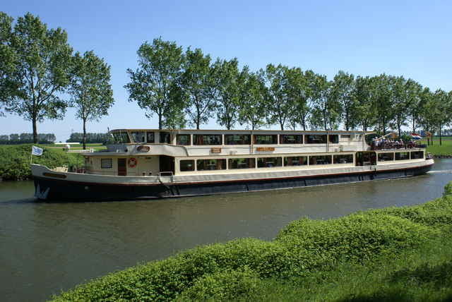
Diese Tour verläuft zwischen Maas, Julianakanal und den Maasplassen. Die Gegend ist flach und sehr ländlich geprägt. Die südlichste Stelle ist der alte Ortskern von Urmond, wo es mehrere Einkehrmöglichkeiten gibt.

Further information at

http://www.stevensweert.com/

Galeria trasy

Mapa trasy i profil wysokości

  • Open Street Map
  • Google
Minimum height 9 m Maximum height 68 m Widok szczegółowy

More about the tour author

tourenfahrer
Member since 2008

Send private message

Komentarze

Der Start- und Endpunkt ist der Stevensweerter Weg in Maasbracht. Gut zu erreichen über die neue Maastalautobahn A 73.

GPS tracks

Trackpoints
  • GPX / Garmin Map Source (gpx) download
  • TCX / Garmin Training Center® (tcx) download
  • CRS / Garmin Training Center® (crs) download
  • Google Earth (kml) download
  • G7ToWin (g7t) download
  • TTQV (trk) download
  • Overlay (ovl) download
  • Fugawi (txt) download
  • Kompass (DAV) Track (tk) download
  • Karta trasy (pdf) download
  • Original file of the author (gpx) download

More about the tour author

tourenfahrer
Member since 2008

Send private message
Share track
Add to my favorites
Remove from my favorites
Edit tags
My score
Rate
Trasa: Zwischen Maas und Julianakanal
Rodzaj: Rower trekkingowy
Długość: 56,9 km
Evaluated on:
Czas trwania:
Day(s)
Hour(s)
Minute(s)
Ocena: Krajobraz Czynnik zadowolenia Kondycja Technika