

- Rundkurs Im Uhrzeigersinn
- Start/Ziel: Andrian/Dorfplatz
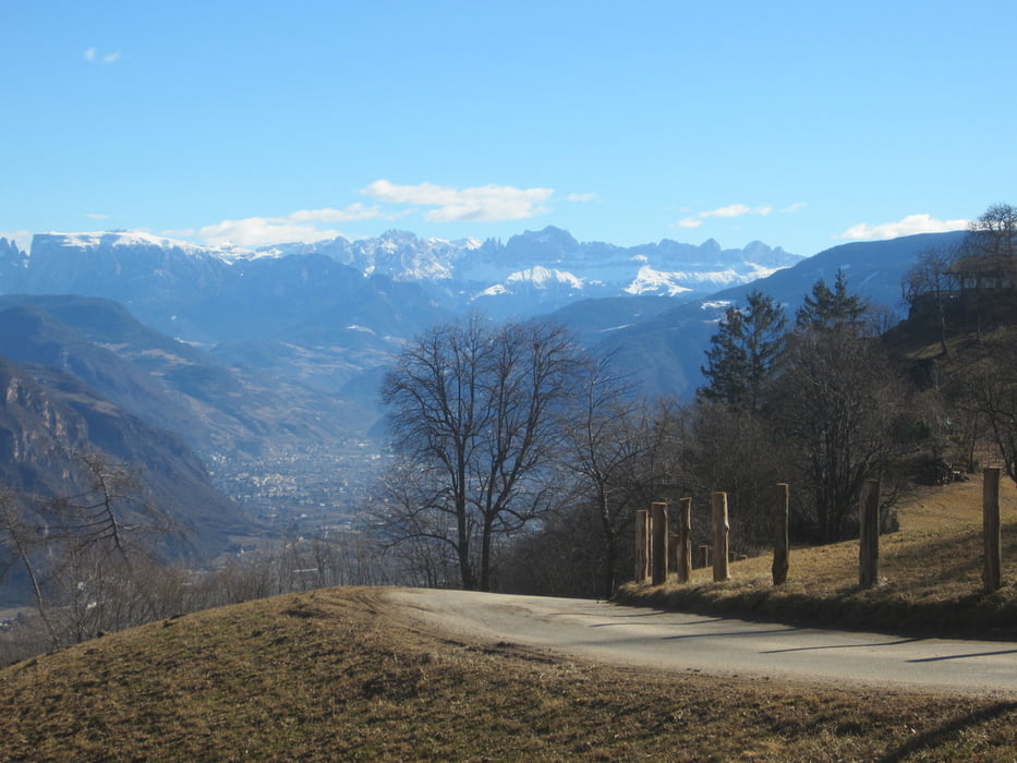
- Von Andrian (MH 283) auf geteerten Feldwegen/Nebenstrassen nach Pauls (KM 6,8-MH 367) zu unserer ersten Rast, der weitum bekannten Konditorei "Peter&Paul. Weiter auf wenig befahrener Landstrasse durch das malerische Weindorf "Pauls", bis nach St. Michael/Eppan (KM 9,2 MH 420).Beginn des Anstiegs auf Teerstrasse nach Perdonig (KM 15,1 MH 800). PS. Trinkwasser-Brunnen. Weiter zum Panoramarestaurant "Lipphof" (KM 15,9 MH 790). In der Fraktion "Gaid" (KM 18,8 MH 908) endet die Asphaltstrasse. Der Aufstieg nach "Gaid" ist angenehm ansteigend/mittesteil mit einigen kurzen etwas steileren Teilstücken.
- In Gaid beginnt die Abfahrt. Auf einem Karrenweg/Steig(S1-S2, kurze Abschnitte S3) fahren wir durch malerische Buchen-/Birkenwälder hinunter in`s Etschtal, zurück zu unserem Ausgangspunkt, nach Andrian (KM 26,1 MH 283).
Galeria trasy


Mapa trasy i profil wysokości
Minimum height 165 m
Maximum height 913 m
More about the tour author
|
|
MargesinFriedrich |
Komentarze

GPS tracks
Trackpoints-
GPX / Garmin Map Source (gpx) download
-
TCX / Garmin Training Center® (tcx) download
-
CRS / Garmin Training Center® (crs) download
-
Google Earth (kml) download
-
G7ToWin (g7t) download
-
TTQV (trk) download
-
Overlay (ovl) download
-
Fugawi (txt) download
-
Kompass (DAV) Track (tk) download
-
Karta trasy (pdf) download
-
Original file of the author (gpx) download
More about the tour author
|
|
MargesinFriedrich |
Add to my favorites
Remove from my favorites
Edit tags
Open track
My score
Rate