


Ich radelte auf meiner Lieblingsstrecke von Homburg Schwarzenbach nach Kirkel Neuhäusel.
Am Abend radelte ich auf dem Radweg in Richtung Rohrbach um aber den Weg in Richtung Pfeifferwald zu verlassen und dann im Tal nach Niederwürzbach zu kullern.
Von Niederwürzbach fuhr ich auf die gegenüberliegende Anhöhe und nach Biesingen. Ich nahm das vereiste Verbindungssträßchen nach Alschbach um anschließend über Lautzkirchen in das Bliestal zu gelangen.
Auf dem dortigen Radweg fuhr ich zu meinem Ausgangspunkt zurück.
Further information at
https://de.wikipedia.org/wiki/Sankt_Ingbert-Kirkeler_WaldgebietGaleria trasy
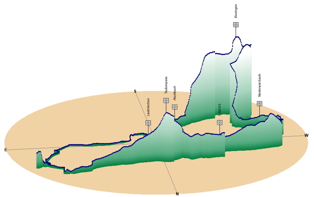
Mapa trasy i profil wysokości
Minimum height 221 m
Maximum height 378 m
More about the tour author
|
|
Pheinz |
Komentarze

Start und Ziel in Homburg Schwarzenbach.
GPS tracks
Trackpoints-
GPX / Garmin Map Source (gpx) download
-
TCX / Garmin Training Center® (tcx) download
-
CRS / Garmin Training Center® (crs) download
-
Google Earth (kml) download
-
G7ToWin (g7t) download
-
TTQV (trk) download
-
Overlay (ovl) download
-
Fugawi (txt) download
-
Kompass (DAV) Track (tk) download
-
Karta trasy (pdf) download
-
Original file of the author (gpx) download
More about the tour author
|
|
Pheinz |
Add to my favorites
Remove from my favorites
Edit tags
Open track
My score
Rate