
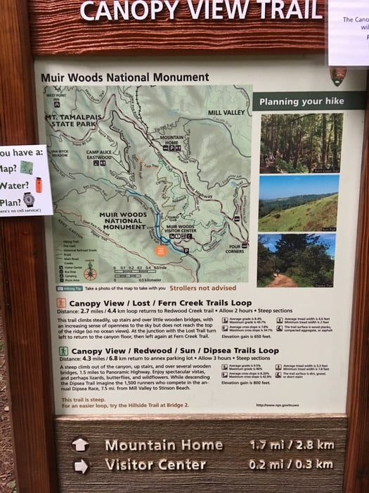

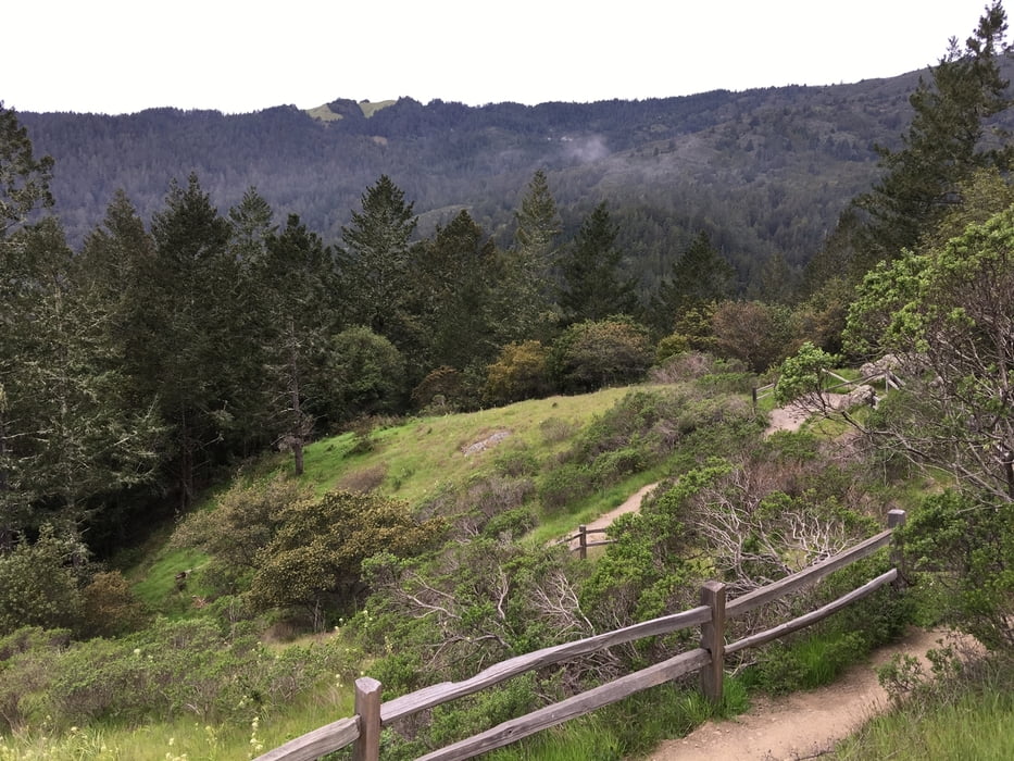
Die Tour bietet einen guten Überblick über Muir Woods und ist ein schöner Ausschnitt der Golden Gate National Recreation Area. Sie startet am Visitor Center und führt zunächst über den Hauptweg in Muir Woods. Dieser Weg beschreibt die eindrucksvollen Bäume von Muir Woods und ist geeignet für Rollstuhlfahrer und Kinderwagen. Der Einstieg in den Loop Trail ist beschildert und führt die Wanderer über ein paar Stufen abseits des vielbegangenen Lehrpfads. Insgesamt ist die Tour gut beschildert und auch einfach zu meistern. Es ist empfehlenswert die Tour früh am Tag zu beginnen (8 Uhr bis 8:30 Uhr) da Parkplätze nur in begrenzter Anzahl vorhanden sind. Der Eintritt zum Park kostet 10 USD pro Person und wird am Visitor Center kassiert. Da das Center erst um 9 Uhr öffnet ist der Eintritt zuvor frei. Es ist auch möglich das Auto am Panoramic Highway zu parken und erst zum Vistor Center abzusteigen. Damit kann das Parkproblem später am Vormittag umgangen werden.
Further information at
https://www.nps.gov/muwo/index.htmGaleria trasy
Mapa trasy i profil wysokości
Minimum height 34 m
Maximum height 291 m
More about the tour author

|
Christian78 |
Komentarze

Die Tour startet und endet nahe dem Visitor Center, 1 Muir Woods Rd, Mill Valley, CA 94941, USA. Parkplätze sind am Vistor Center vorhanden, allerdings nur in begrenzter Anzahl.
GPS tracks
Trackpoints-
GPX / Garmin Map Source (gpx) download
-
TCX / Garmin Training Center® (tcx) download
-
CRS / Garmin Training Center® (crs) download
-
Google Earth (kml) download
-
G7ToWin (g7t) download
-
TTQV (trk) download
-
Overlay (ovl) download
-
Fugawi (txt) download
-
Kompass (DAV) Track (tk) download
-
Karta trasy (pdf) download
-
Original file of the author (gpx) download
More about the tour author
|
|
Christian78 |
Add to my favorites
Remove from my favorites
Edit tags
Open track
My score
Rate