Login

Zapomniałeś swój login?

Cookies have to be accepted!
Your browser's cookie functionality is disabled. Please enable this functionality.

Not a member yet?

Register now
Login

Available for registred users only

Log in to use this feature.

Zapomniałeś swój login?

Cookies have to be accepted!
Your browser's cookie functionality is disabled. Please enable this functionality.

Not a member yet?

Register now
Filter
Kategorie
Advanced filters
  • Długość (km)
  • Wysokość
Zapisz filtr Reset filter

TrackRank

QRCode

Technical data

Długość28,3 km Wysokość1122 m Way down1122 m Czas trwania04:00 h:m Data12.05.2017
Oceny Author Krajobraz Czynnik zadowolenia Kondycja Technika

Statystyka

360 Widoki 1 Ocena 69 Downloads / Pliki do pobrania 5.00 Przeciętnie
Rate
  • Karta trasy
  • Dojazd
  • Downloads / Pliki do pobrania
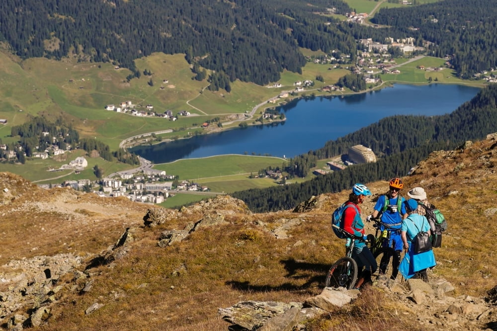
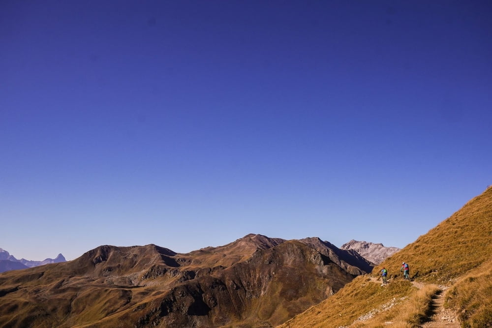
Bis Tschuggen leicht, dann stark ansteigender Trail zur Bergstation (nur im Winter in Betrieb). Die Anstrengung lohnt: Der Trail über den Grat bietet eine grandiose Aussicht und Fahrspaß pur. Flowig mit einigen technischen Stellen geht es schließlich bergab bis zum Davoser See.

Further information at

https://supertrail.guide/touren/davos-pischa/

Galeria trasy

Mapa trasy i profil wysokości

  • Open Street Map
  • Google
Minimum height 1537 m Maximum height 2485 m Widok szczegółowy

More about the tour author

SupertrailGuide
Member since 2017

Send private message

Komentarze

luckymaaa on 21.09.2018

superschön

die Tour ist, selbst mit dem Ebike anstrengend, aber dadurch das es keine Bahn hoch gibt, sind die Trails nicht so ausgefahren wie z.B. die vom Chöbschhorn. Die Trails selber sind mit vom schönsten was ich je gefahren bin

GPS tracks

Trackpoints
  • GPX / Garmin Map Source (gpx) download
  • TCX / Garmin Training Center® (tcx) download
  • CRS / Garmin Training Center® (crs) download
  • Google Earth (kml) download
  • G7ToWin (g7t) download
  • TTQV (trk) download
  • Overlay (ovl) download
  • Fugawi (txt) download
  • Kompass (DAV) Track (tk) download
  • Karta trasy (pdf) download
  • Original file of the author (gpx) download

More about the tour author

SupertrailGuide
Member since 2017

Send private message
Share track
Add to my favorites
Remove from my favorites
Edit tags
My score
Rate
Trasa: PISCHA - präsentiert von supertrail.guide
Rodzaj: Rower górski (MTB)
Długość: 28,3 km
Evaluated on:
Czas trwania:
Day(s)
Hour(s)
Minute(s)
Ocena: Krajobraz Czynnik zadowolenia Kondycja Technika