


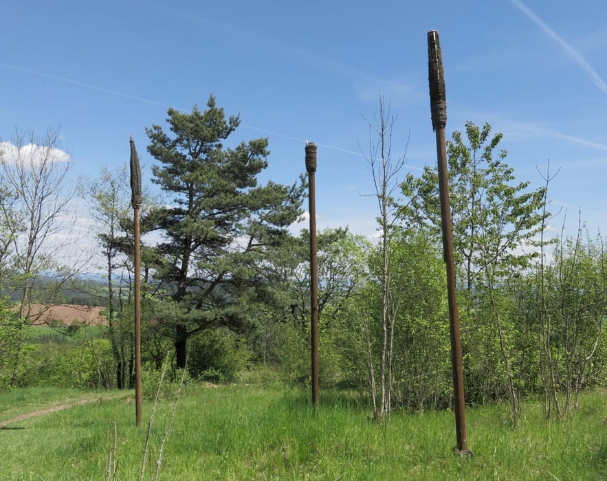
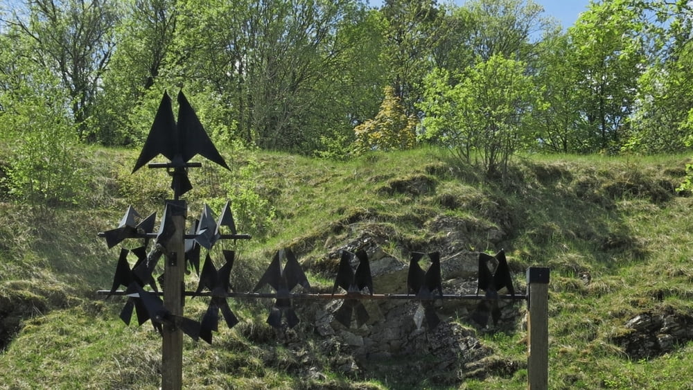
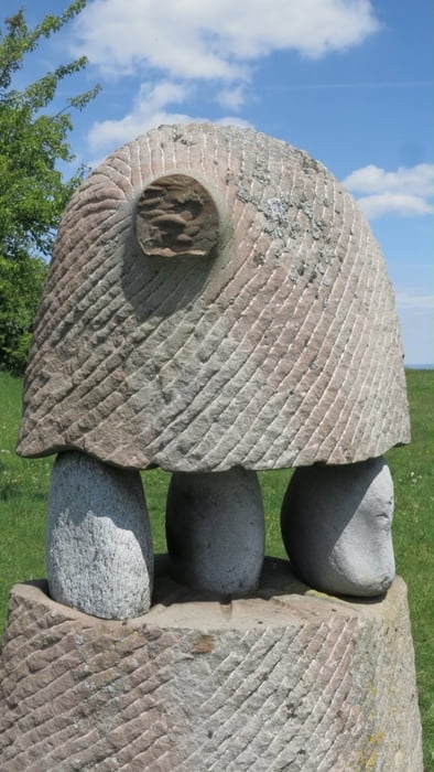
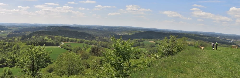
Vom Parkplatz nach rechts, an Gabelung halbrechts weiter zur Straße; nach links auf dieser kurz weiter, bald halbrechts mit Gelbpunkt nach Wohnsgehaig. Links durch den Ort, am Ortsende beinnt am Parkplatz der kurze Anstieg zum "NaturKunstRaum": bald liegt die erste Skulptur vor uns. Es geht aufwärts und auf dem Plateau mit 360°- Rundumsicht liegen weitere Werke vor uns.
Abwärts zum Parkplatz, nach links über Straße hinweg folgen wir dem "Fränkischen Gebirgsweg", kurz vor Harloth in kleinem Hohlweg links über die Höhe weiter. An Wegweiser am Waldrand auf Forstweg in schönem Mischwald zum Parkplatz.
HINWEIS zum Video:
Mit Mozilla Firefox u.a. mit Flash- Player Plugin startet das Video direkt bei der Bildershow.
Andernfalls verwendet ihr in eurem Browser den Link:
https://youtu.be/kcyVI3W1nW4
Galeria trasy

Mapa trasy i profil wysokości
Minimum height 388 m
Maximum height 577 m
More about the tour author
|
|
heinz-57 |
Komentarze

Von Heiligenstadt oder Waischenfeld kommend, fährt man unterhalb Plankenfels vorbei nach Truppach. Am Ortseingang rechts nach Mengersdorf, an Gasthaus links zum Parkplatz an der Kirche.
GPS tracks
Trackpoints-
GPX / Garmin Map Source (gpx) download
-
TCX / Garmin Training Center® (tcx) download
-
CRS / Garmin Training Center® (crs) download
-
Google Earth (kml) download
-
G7ToWin (g7t) download
-
TTQV (trk) download
-
Overlay (ovl) download
-
Fugawi (txt) download
-
Kompass (DAV) Track (tk) download
-
Karta trasy (pdf) download
-
Original file of the author (gpx) download
More about the tour author
|
|
heinz-57 |
Add to my favorites
Remove from my favorites
Edit tags
Open track
My score
Rate