

Start: Friedlwirt in Unken, weiter entlang dem Unkenbach folgend und über die Brücke (Fußtalstube) links Richtung Loferer Alm, Steinplatte fahren. Weiterfahrt bis zur Mittleren Fußtalstube und in Richtung Mösernalm-Winklmoosalm-Steinplatte (rechts) abzweigen. Von der Steinplatte Abfahrt zur Winklmoosalm (Einkehr) und weiter über das Heutal zurück zum Ausgangspunkt.
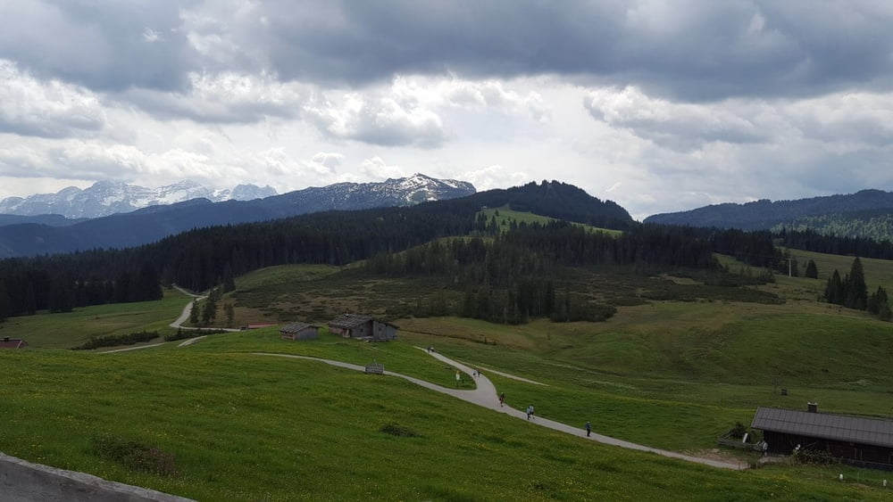
Landschaftlich eine sehr schöne Tour (entlang dem Unkenbach), bei der Auffahrt bzw. von der Steinplatte tolle Ausblicke ins "Salzburgische, Bayrische und Tiroler Land".
Viel Spass!
Galeria trasy

Mapa trasy i profil wysokości
Minimum height 622 m
Maximum height 1648 m
More about the tour author
|
|
MTBiker55 |
Komentarze

Von Norden kommen in Unken rechts ins Heutal - Friedlwirt der Beschilderung folgen.
GPS tracks
Trackpoints-
GPX / Garmin Map Source (gpx) download
-
TCX / Garmin Training Center® (tcx) download
-
CRS / Garmin Training Center® (crs) download
-
Google Earth (kml) download
-
G7ToWin (g7t) download
-
TTQV (trk) download
-
Overlay (ovl) download
-
Fugawi (txt) download
-
Kompass (DAV) Track (tk) download
-
Karta trasy (pdf) download
-
Original file of the author (gpx) download
More about the tour author
|
|
MTBiker55 |
Add to my favorites
Remove from my favorites
Edit tags
Open track
My score
Rate