Login

Zapomniałeś swój login?

Cookies have to be accepted!
Your browser's cookie functionality is disabled. Please enable this functionality.

Not a member yet?

Register now
Login

Available for registred users only

Log in to use this feature.

Zapomniałeś swój login?

Cookies have to be accepted!
Your browser's cookie functionality is disabled. Please enable this functionality.

Not a member yet?

Register now
Filter
Kategorie
Advanced filters
  • Długość (km)
  • Wysokość
Zapisz filtr Reset filter

TrackRank

QRCode

Technical data

Długość28,6 km Wysokość1438 m Way down1407 m Czas trwania06:00 h:m Data28.05.2017
Oceny Author Krajobraz Czynnik zadowolenia Kondycja Technika

Statystyka

699 Widoki Oceny 52 Downloads / Pliki do pobrania Przeciętnie
Rate
  • Karta trasy
  • Dojazd
  • Downloads / Pliki do pobrania

Endurotour S2-S3

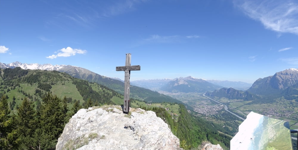
Vom Rastplatz Heidiland über Bad Ragaz, Pfäfers, St. Margathenberg zum Pizalun und weiter zur Chemmispitze. Bis St. Margatenberg kann man auch auf Strasse bzw. mit dem Postbus hoch.

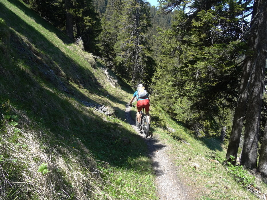
Aufwärts einige Trails, je nach Kraft evtl. schieben.

Abwärts Chemmispitze S2, nach Wirtschaft wieder S2. Dann 70hm schlechten ausgesetzten Bergweg abwärts schieben. Dann wieder S2 ins Tal.


Galeria trasy

Mapa trasy i profil wysokości

  • Open Street Map
  • Google
Minimum height 491 m Maximum height 1763 m Widok szczegółowy

More about the tour author

skyhopper
Member since 2005

Send private message

Komentarze

parken am Autobahnrasthof Heidiland.


GPS tracks

Trackpoints
  • GPX / Garmin Map Source (gpx) download
  • TCX / Garmin Training Center® (tcx) download
  • CRS / Garmin Training Center® (crs) download
  • Google Earth (kml) download
  • G7ToWin (g7t) download
  • TTQV (trk) download
  • Overlay (ovl) download
  • Fugawi (txt) download
  • Kompass (DAV) Track (tk) download
  • Karta trasy (pdf) download
  • Original file of the author (gpx) download

More about the tour author

skyhopper
Member since 2005

Send private message
Share track
Add to my favorites
Remove from my favorites
Edit tags
My score
Rate
Trasa: Pizalun-Chimmispitz
Rodzaj: Rower górski (MTB)
Długość: 28,6 km
Evaluated on:
Czas trwania:
Day(s)
Hour(s)
Minute(s)
Ocena: Krajobraz Czynnik zadowolenia Kondycja Technika