

Dit is de tweede dag van de fietstocht langs de Hadrianus muur en Wainwrights Coast to coast route. De low budget route gaat van camping naar camping. Het gedeelte langs de Hadrianus muur volgt de National Cycle Route 72 tot Carlisle. Na Carlisle buigt de track in richting van St. Bees, het startpunt van Wainwrights coast to coast van de Ierse zee naar de Noordzee.. Deze coast to coast route is van oorsprong een wandelpad. Ik heb geprobeerd om fietspaden en stille wegen op te nemen die zo dicht mogelijk bij de wandelroute liggen.
This is the second day of the cycle route along the Hadrian's Wall and Wainwrights Coast tot Coast.
The low budget route goes from campsite to campsite . The part along the Hadrian's Wall follows the National Cycle Route 72 till Carlisle. After Carlisle the track bends in the direction of St. Bees the starting point of Wainwrights Coast to Coast from the Irish sea to the North sea. This coast to coast route is a walking route. I tried to use cyclingpaths and quiet roads that are situated as near as possible to the walkingroute.
Galeria trasy

Mapa trasy i profil wysokości
Minimum height 99999 m
Maximum height -99999 m
More about the tour author

|
partnair |
Komentarze

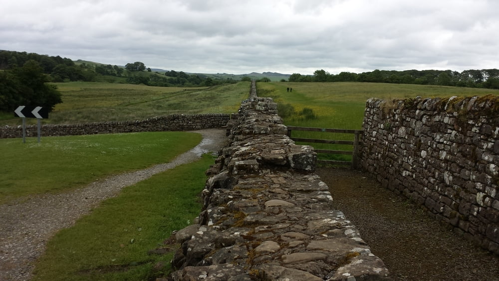
Vanaf camping in Melkridge daal je af naar het gelijknamige plaatsje. De tocht gaat gedeeltelijk door de noordelijke Pennines. De heuvels zijn mild. Soms kom je op halfverharde fietspaden maar die zijn niet lang. Na 40 kilometer kom je in Carlisle. Bezoek in ieder geval de cathedraal. In en na Carlisle gaat de rit tot Dalston over een redelijk drukke weg richting de camping van Blaithwaite house. Op het pleintje in Dalston is een heel gezellige tearoom met diverse soorten gebak. Blaithwaite House is een te dure camping met weinig comfort. Schuilen doe je daar in een paardentrailer.
From the Melkridge campsite you go downhill to the village withe the same name. The tour goes further trough the Northern Pennines. The hills are mostly gentle. Sometimes you have to ride on a unpaved path, but that is never too long. After 27 miles you will arrive in Carlisle. Do visit the catherdral. In and after Carlisle untill Dalston the road is rather busy. In Dalston is a cosy tearoom with all kinds of cakes. Blaithwaite house is a expensive campsite without little comfort. A horsetrailer will be your shelter.
GPS tracks
Trackpoints-
GPX / Garmin Map Source (gpx) download
-
TCX / Garmin Training Center® (tcx) download
-
CRS / Garmin Training Center® (crs) download
-
Google Earth (kml) download
-
G7ToWin (g7t) download
-
TTQV (trk) download
-
Overlay (ovl) download
-
Fugawi (txt) download
-
Kompass (DAV) Track (tk) download
-
Karta trasy (pdf) download
-
Original file of the author (gpx) download
More about the tour author
|
|
partnair |
Add to my favorites
Remove from my favorites
Edit tags
Open track
My score
Rate